Saint-Hyacinthe Aerodrome
| Saint-Hyacinthe Aerodrome | |||||||||||
|---|---|---|---|---|---|---|---|---|---|---|---|
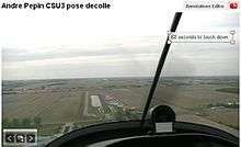 A Sinus landing runway 02. | |||||||||||
| Summary | |||||||||||
| Airport type | Private | ||||||||||
| Operator | Aeroservices St-Hyacinthe | ||||||||||
| Location | Saint-Hyacinthe, Quebec | ||||||||||
| Time zone | EST (UTC−05:00) | ||||||||||
| • Summer (DST) | EDT (UTC−04:00) | ||||||||||
| Elevation AMSL | 118 ft / 36 m | ||||||||||
| Coordinates | 45°36′24″N 073°00′54″W / 45.60667°N 73.01500°WCoordinates: 45°36′24″N 073°00′54″W / 45.60667°N 73.01500°W | ||||||||||
| Map | |||||||||||
 CSU3 Location in Quebec | |||||||||||
| Runways | |||||||||||
| |||||||||||
|
Source: Canada Flight Supplement[1] | |||||||||||
Saint-Hyacinthe Aerodrome, (TC LID: CSU3), is located 3 nautical miles (5.6 km; 3.5 mi) west of Saint-Hyacinthe, Quebec, Canada.
The Saint-Hyacinthe Aerodrome is an example of general aviation diversity driven by private management.
Almost all airplanes on floats land on its man-made water basin, parallel to the runway, single and twin engine conventional aircraft, ultralight two axis, ultralight three axis, aerobatic airplanes, vintage aircraft and motor gliders fly regularly from the narrow (75 ft (23 m) but well maintained runway.
The newly paved taxiway keeps traffic moving around smoothly.
Weekends with nice weather are particularly busy. Aviation enthusiasts can admire aerobatics performed in the aerobatic box at the west of the airport, formation flights, low passes, overshoot training etc.
Aviation schools and repair shops are present.
All hangar spaces are sold out and more hangars under construction drive the need for more space for hangars and an extra runway to permit landings when crosswinds are to strong to permit a safe return in such conditions.
The only runway stays quite busy during the days when strong winds blow perpendicularly to the runway axis. Strong winds are typical of this area, much stronger than nearby airports, sometime in excess of 40 km/h (22 kn; 25 mph). Crosswinds of this strength rattle the hangars and keep almost everybody grounded.
References
- ↑ Canada Flight Supplement. Effective 0901Z 19 July 2018 to 0901Z 13 September 2018.
External links
| By name | |
|---|---|
| By location indicator | |
| By province/territory | |
| By area | |
| National Airports System | |
| Related | |
| |