Saint-Damase-de-L'Islet
| Saint-Damase-de-L'Islet | |
|---|---|
| Municipality | |
.jpg) | |
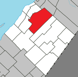 Location within L'Islet RCM | |
 Saint-Damase-de-L'Islet Location in southern Quebec | |
| Coordinates: 47°12′N 70°08′W / 47.200°N 70.133°WCoordinates: 47°12′N 70°08′W / 47.200°N 70.133°W[1] | |
| Country | Canada |
| Province | Quebec |
| Region | Chaudière-Appalaches |
| RCM | L'Islet |
| Constituted | November 9, 1898 |
| Government[2] | |
| • Mayor | Paulette Lord |
| • Federal riding |
Montmagny—L'Islet— Kamouraska—Rivière- du-Loup |
| • Prov. riding | Côte-du-Sud |
| Area[2][3] | |
| • Total | 249.60 km2 (96.37 sq mi) |
| • Land | 244.24 km2 (94.30 sq mi) |
| Population (2011)[3] | |
| • Total | 591 |
| • Density | 2.4/km2 (6/sq mi) |
| • Pop 2006-2011 |
|
| • Dwellings | 335 |
| Time zone | UTC−5 (EST) |
| • Summer (DST) | UTC−4 (EDT) |
| Postal code(s) | G0R 2X0 |
| Area code(s) | 418 and 581 |
| Highways |
|
Saint-Damase-de-L'Islet is a municipality in Quebec, Canada, with a population of about 600 people nestled in the Appalachian mountains. It is located about 15 kilometres (9.3 mi) southeast of Saint-Jean-Port-Joli. It is named after the Pope Damasus I and Damase Ouellet (1826–1908), which is known as the pioneer of the town.
The town was first named "Municipalité du canton d'Ashford" in 1898 and got its current name in 1955.
It is known for its local Chicken Festival every September.
See also
References
External links

Adjacent Municipal Subdivisions | ||||||||||
|---|---|---|---|---|---|---|---|---|---|---|
| ||||||||||
| Cities & Towns | |
|---|---|
| Municipalities | |
| Parishes | |
| |
This article is issued from
Wikipedia.
The text is licensed under Creative Commons - Attribution - Sharealike.
Additional terms may apply for the media files.