Saint-Étienne-de-Bolton, Quebec
| Saint-Étienne-de-Bolton | |
|---|---|
| Municipality | |
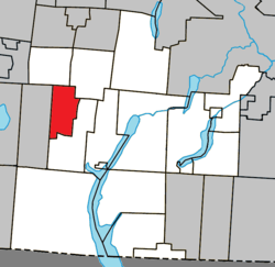 Location within Memphrémagog RCM | |
 St-Étienne-de-Bolton Location in southern Quebec | |
| Coordinates: 45°16′N 72°22′W / 45.27°N 72.37°WCoordinates: 45°16′N 72°22′W / 45.27°N 72.37°W[1] | |
| Country |
|
| Province |
|
| Region | Estrie |
| RCM | Memphrémagog |
| Constituted | May 27, 1939 |
| Government[2][3] | |
| • Mayor | Pierre Patry |
| • Federal riding | Brome—Missisquoi |
| • Prov. riding | Orford |
| Area[2][4] | |
| • Total | 49.00 km2 (18.92 sq mi) |
| • Land | 46.99 km2 (18.14 sq mi) |
| Population (2011)[4] | |
| • Total | 534 |
| • Density | 11.4/km2 (30/sq mi) |
| • Pop 2006-2011 |
|
| • Dwellings | 426 |
| Time zone | UTC−5 (EST) |
| • Summer (DST) | UTC−4 (EDT) |
| Postal code(s) | J0E 2E0 |
| Area code(s) | 450 and 579 |
| Highways |
|
| Website |
www |
Saint-Étienne-de-Bolton is a municipality of 500 people, part of the Memphrémagog Regional County Municipality in the Eastern Townships region of Quebec, Canada.
Demographics
Population
Population trend:[5]
| Census | Population | Change |
|---|---|---|
| 2011 | 534 | |
| 2006 | 496 | |
| 2001 | 463 | |
| 1996 | 400 | |
| 1991 | 377 | N/A |
Language
Mother tongue (2011)[4]
| Language | Population | Pct (%) |
|---|---|---|
| French only | 445 | 84.0% |
| English only | 60 | 11.3% |
| English and French | 5 | 0.9% |
| Non-official languages | 20 | 3.8% |
See also
References
- ↑ Reference number 56455 of the Commission de toponymie du Québec (in French)
- 1 2 Ministère des Affaires municipales, des Régions et de l'Occupation du territoire: Saint-Étienne-de-Bolton
- ↑ Parliament of Canada Federal Riding History: BROME--MISSISQUOI (Quebec)
- 1 2 3 2011 Statistics Canada Census Profile: Saint-Étienne-de-Bolton, Quebec
- ↑ Statistics Canada: 1996, 2001, 2006, 2011 census
External links

Places adjacent to Saint-Étienne-de-Bolton, Quebec | ||||||||||
|---|---|---|---|---|---|---|---|---|---|---|
| ||||||||||
| Cities & Towns | |
|---|---|
| Municipalities | |
| Townships | |
| Villages | |
| |
This article is issued from
Wikipedia.
The text is licensed under Creative Commons - Attribution - Sharealike.
Additional terms may apply for the media files.