Saffig
| Saffig | ||
|---|---|---|
| ||
 Saffig Location of Saffig within Mayen-Koblenz district 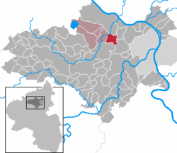 | ||
| Coordinates: 50°22′48″N 7°24′57″E / 50.38000°N 7.41583°ECoordinates: 50°22′48″N 7°24′57″E / 50.38000°N 7.41583°E | ||
| Country | Germany | |
| State | Rhineland-Palatinate | |
| District | Mayen-Koblenz | |
| Municipal assoc. | Pellenz (Verbandsgemeinde) | |
| Government | ||
| • Mayor | Dirk Rohm | |
| Area | ||
| • Total | 6.96 km2 (2.69 sq mi) | |
| Elevation | 130 m (430 ft) | |
| Population (2017-12-31)[1] | ||
| • Total | 2,176 | |
| • Density | 310/km2 (810/sq mi) | |
| Time zone | CET/CEST (UTC+1/+2) | |
| Postal codes | 56648 | |
| Dialling codes | 02625 | |
| Vehicle registration | MYK | |
| Website | www.saffig.de | |

Saffig is a municipality in the district of Mayen-Koblenz in Rhineland-Palatinate, western Germany.
The emblem
The organ pipes and the ear show St. Cäcilia, the patron saint of the Catholic church of Saffig. The lava dome shows the territory of vulcanos, where Saffig is.
History
The village was first referenced in 1258 as "Saffge". Saffig was a fiefdom of Cologne until 1481, when it became a fiefdom of the family von der Leyen. After the annexation of sinistral territory of the Rhine during the French Revolutionary Wars (1794–1815), Saffig was a "Mairie" of France. Saffig has been part of the Pellenz Verbandsgemeinde since 1992.
Buildings and sights
- St. Cäcilia Catholic Church - Designed by Balthasar Neumann (1739–1742) and his pupil Johannes Seiz
- The Palace Garden - Formerly part of the Palace territory of the family von der Leyen
- Synagogue - Now a memorial
- "Von-der-Leyen Halle" - A multipurpose hall
References
- ↑ Statistisches Landesamt Rheinland-Pfalz "Bevölkerungsstand 2017 - Gemeindeebene" Check
|url=value (help). Statistisches Landesamt Rheinland-Pfalz (in German). 2018.
| Authority control |
|---|
This article is issued from
Wikipedia.
The text is licensed under Creative Commons - Attribution - Sharealike.
Additional terms may apply for the media files.