Baar, Rhineland-Palatinate
| Baar | |
|---|---|
 Baar Location of Baar within Mayen-Koblenz district 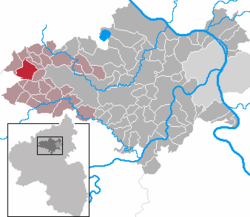 | |
| Coordinates: 50°20′37″N 7°2′03″E / 50.34361°N 7.03417°ECoordinates: 50°20′37″N 7°2′03″E / 50.34361°N 7.03417°E | |
| Country | Germany |
| State | Rhineland-Palatinate |
| District | Mayen-Koblenz |
| Municipal assoc. | Vordereifel |
| Government | |
| • Mayor | Heribert Hänzgen |
| Area | |
| • Total | 11.74 km2 (4.53 sq mi) |
| Elevation | 420 m (1,380 ft) |
| Population (2017-12-31)[1] | |
| • Total | 717 |
| • Density | 61/km2 (160/sq mi) |
| Time zone | CET/CEST (UTC+1/+2) |
| Postal codes | 56729 |
| Dialling codes | 02656 |
| Vehicle registration | MYK |
| Website | www.baar-eifel.de |
Baar is a municipality in the district of Mayen-Koblenz in Rhineland-Palatinate, western Germany.
References
- ↑ Statistisches Landesamt Rheinland-Pfalz "Bevölkerungsstand 2017 - Gemeindeebene" Check
|url=value (help). Statistisches Landesamt Rheinland-Pfalz (in German). 2018.
| Authority control |
|---|
This article is issued from
Wikipedia.
The text is licensed under Creative Commons - Attribution - Sharealike.
Additional terms may apply for the media files.