Sadler, Texas
| Sadler, Texas | |
|---|---|
| City | |
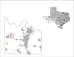
 Location of Sadler, Texas | |
 | |
| Coordinates: 33°40′53″N 96°50′47″W / 33.68139°N 96.84639°WCoordinates: 33°40′53″N 96°50′47″W / 33.68139°N 96.84639°W | |
| Country | United States |
| State | Texas |
| County | Grayson |
| Area | |
| • Total | 0.71 sq mi (1.85 km2) |
| • Land | 0.71 sq mi (1.85 km2) |
| • Water | 0.0 sq mi (0.0 km2) |
| Elevation | 719 ft (219 m) |
| Population (2010) | |
| • Total | 343 |
| • Density | 479/sq mi (185.0/km2) |
| Time zone | UTC-6 (Central (CST)) |
| • Summer (DST) | UTC-5 (CDT) |
| ZIP code | 76264 |
| Area code(s) | 903 |
| FIPS code | 48-64088[1] |
| GNIS feature ID | 1367110[2] |
| Website |
cityofsadler |
Sadler is a city in Grayson County, Texas, United States. The population was 343 at the 2010 census,[3] down from 404 at the 2000 census. It is part of the Sherman–Denison Metropolitan Statistical Area.
Geography
Sadler is located in western Grayson County at 33°40′53″N 96°50′47″W / 33.68139°N 96.84639°W (33.681387, -96.846321).[4] The U.S. Route 82 freeway runs through the southern part of the city, leading east 17 miles (27 km) to Sherman, the county seat, and west 5 miles (8 km) to Whitesboro.
According to the United States Census Bureau, Sadler has a total area of 0.73 square miles (1.9 km2), all of it land.[3]
Climate
The climate in this area is characterized by hot, humid summers and generally mild to cool winters. According to the Köppen Climate Classification system, Sadler has a humid subtropical climate, abbreviated "Cfa" on climate maps.[5]
Demographics
| Historical population | |||
|---|---|---|---|
| Census | Pop. | %± | |
| 1970 | 309 | — | |
| 1980 | 329 | 6.5% | |
| 1990 | 316 | −4.0% | |
| 2000 | 404 | 27.8% | |
| 2010 | 343 | −15.1% | |
| Est. 2016 | 362 | [6] | 5.5% |
| U.S. Decennial Census[7] | |||
As of the census[1] of 2000, there were 404 people, 167 households, and 112 families residing in the city. The population density was 673.4 people per square mile (260.0/km²). There were 177 housing units at an average density of 295.0 per square mile (113.9/km²). The racial makeup of the city was 98.76% White, 0.25% African American and 0.99% Native American. Hispanic or Latino of any race were 0.99% of the population.
There were 167 households out of which 29.3% had children under the age of 18 living with them, 54.5% were married couples living together, 8.4% had a female householder with no husband present, and 32.9% were non-families. 30.5% of all households were made up of individuals and 15.0% had someone living alone who was 65 years of age or older. The average household size was 2.42 and the average family size was 3.04.
In the city, the population was spread out with 25.7% under the age of 18, 7.4% from 18 to 24, 25.5% from 25 to 44, 26.2% from 45 to 64, and 15.1% who were 65 years of age or older. The median age was 38 years. For every 100 females, there were 94.2 males. For every 100 females age 18 and over, there were 87.5 males.
The median income for a household in the city was $26,250, and the median income for a family was $29,250. Males had a median income of $30,893 versus $21,667 for females. The per capita income for the city was $15,302. About 11.9% of families and 14.7% of the population were below the poverty line, including 17.2% of those under age 18 and 7.8% of those age 65 or over.
Education
Sadler is served by the S and S Consolidated Independent School District.
References
- 1 2 "American FactFinder". United States Census Bureau. Retrieved 2008-01-31.
- ↑ "US Board on Geographic Names". United States Geological Survey. 2007-10-25. Retrieved 2008-01-31.
- 1 2 "Geographic Identifiers: 2010 Demographic Profile Data (G001): Sadler city, Texas". American Factfinder. U.S. Census Bureau. Retrieved March 21, 2017.
- ↑ "US Gazetteer files: 2010, 2000, and 1990". United States Census Bureau. 2011-02-12. Retrieved 2011-04-23.
- ↑ Climate Summary for Sadler, Texas
- ↑ "Population and Housing Unit Estimates". Retrieved June 9, 2017.
- ↑ "Census of Population and Housing". Census.gov. Retrieved June 4, 2015.
External links
Municipalities and communities of Grayson County, Texas, United States | ||
|---|---|---|
| Cities | 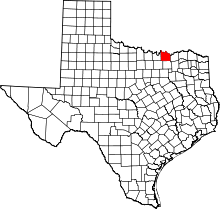 | |
| Towns | ||
| CDPs | ||
| Other unincorporated communities | ||
| Footnotes | ‡This populated place also has portions in an adjacent county or counties | |