Pottsboro, Texas
| Pottsboro, Texas | |
|---|---|
| Town | |
| Motto(s): "Come Play. Come Stay." | |
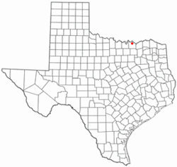 Location of Pottsboro, Texas | |
 | |
| Coordinates: 33°46′54″N 96°40′34″W / 33.78167°N 96.67611°WCoordinates: 33°46′54″N 96°40′34″W / 33.78167°N 96.67611°W | |
| Country | United States |
| State | Texas |
| County | Grayson |
| Area | |
| • Total | 2.9 sq mi (7.4 km2) |
| • Land | 2.9 sq mi (7.4 km2) |
| • Water | 0.0 sq mi (0.0 km2) |
| Elevation | 761 ft (232 m) |
| Population (2010) | |
| • Total | 2,160 |
| • Density | 755/sq mi (291.5/km2) |
| Time zone | UTC-6 (Central (CST)) |
| • Summer (DST) | UTC-5 (CDT) |
| ZIP code | 75076 |
| Area code(s) | 903 |
| FIPS code | 48-59132[1] |
| GNIS feature ID | 1365691[2] |
| Website |
www |
Pottsboro is a town in Grayson County, Texas, United States. The population was 2,160 at the 2010 census,[3] up from 1,579 at the 2000 census. It is part of the Sherman–Denison Metropolitan Statistical Area.
Geography
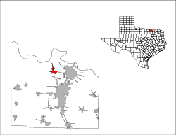
Pottsboro is located in northern Grayson County at 33°46′54″N 96°40′34″W / 33.78167°N 96.67611°W.[4] Texas State Highway 289 passes through the west side of the town, leading south 10 miles (16 km) to Southmayd and north 10 miles to a dead end at Preston on Lake Texoma. Denison is 8 miles (13 km) east of Pottsboro via Farm Road 120, and Sherman, the county seat, is 12 miles (19 km) to the southeast.
According to the United States Census Bureau, Pottsboro has a total area of 2.9 square miles (7.4 km2), all of it land.[3]
History
Pottsboro was established in 1876 by James A. Potts, a pioneer settler who donated land for a town and a right-of-way so that the Missouri–Kansas–Texas Railroad would extend its tracks westward from Denison to his settlement. The community, no doubt aided by its status as a stop on the railroad, grew rapidly for the rest of the 1800s. It incorporated in 1880, and by 1885 its population had reached 200 and it supported a cotton gin, several gristmills, and a number of churches. A post office opened there in 1891
The population reached 454 in 1920 and 500 in 1925. By that time the community was served by some 25 businesses, including a bank, and by two schools with a combined enrollment of 300 students. Pottsboro declined to a population of 358 by 1936 and 312 by the mid-1940s. It then grew to 383 by 1957. The number of businesses had fallen to twelve by 1948, though by the late 1950s it was back up to more than twenty. The town began to grow again during the 1950s, perhaps spurred by the rapid expansion of nearby Denison. By 1967 Pottsboro reported thirty businesses and a population of 750, and by 1990 its population was 1,177. The population grew to 1,579 in 2000.
Demographics
| Historical population | |||
|---|---|---|---|
| Census | Pop. | %± | |
| 1890 | 286 | — | |
| 1900 | 400 | 39.9% | |
| 1910 | 313 | −21.7% | |
| 1920 | 454 | 45.0% | |
| 1930 | 358 | −21.1% | |
| 1940 | 342 | −4.5% | |
| 1950 | 383 | 12.0% | |
| 1960 | 640 | 67.1% | |
| 1970 | 748 | 16.9% | |
| 1980 | 895 | 19.7% | |
| 1990 | 1,177 | 31.5% | |
| 2000 | 1,579 | 34.2% | |
| 2010 | 2,160 | 36.8% | |
| Est. 2016 | 2,306 | [5] | 6.8% |
| U.S. Decennial Census[6] | |||
As of the census[1] of 2000, there were 1,579 people, 586 households, and 454 families residing in the town. The population density was 554.3 people per square mile (213.9/km²). There were 620 housing units at an average density of 217.6 per square mile (84.0/km²). There were 586 households out of which 43.5% had children under the age of 18 living with them, 57.3% were married couples living together, 16.0% had a female householder with no husband present, and 22.5% were non-families. 19.6% of all households were made up of individuals and 9.0% had someone living alone who was 65 years of age or older. The average household size was 2.69 and the average family size was 3.07.
In the town, the population was spread out with 31.4% under the age of 18, 6.6% from 18 to 24, 31.0% from 25 to 44, 21.6% from 45 to 64, and 9.4% who were 65 years of age or older. The median age was 35 years. For every 100 females, there were 90.9 males. For every 100 females age 18 and over, there were 85.1 males.
The median income for a household in the town was $43,977, and the median income for a family was $49,643. Males had a median income of $35,441 versus $24,886 for females. The per capita income for the town was $16,357. About 6.9% of families and 8.2% of the population were below the poverty line, including 10.7% of those under age 18 and 10.4% of those age 65 or over.
Climate
Pottsboro is part of the humid subtropical climate region.
Education
The town is served by the Pottsboro Independent School District.
References
- 1 2 "American FactFinder". United States Census Bureau. Retrieved 2008-01-31.
- ↑ "US Board on Geographic Names". United States Geological Survey. 2007-10-25. Retrieved 2008-01-31.
- 1 2 "Geographic Identifiers: 2010 Demographic Profile Data (G001): Pottsboro town, Texas". American Factfinder. U.S. Census Bureau. Retrieved March 22, 2017.
- ↑ "US Gazetteer files: 2010, 2000, and 1990". United States Census Bureau. 2011-02-12. Retrieved 2011-04-23.
- ↑ "Population and Housing Unit Estimates". Retrieved June 9, 2017.
- ↑ "Census of Population and Housing". Census.gov. Retrieved June 4, 2015.
Municipalities and communities of Grayson County, Texas, United States | ||
|---|---|---|
| Cities | 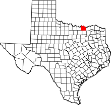 | |
| Towns | ||
| CDPs | ||
| Other unincorporated communities | ||
| Footnotes | ‡This populated place also has portions in an adjacent county or counties | |