São Filipe Airport
| São Filipe Airport | |||||||||||
|---|---|---|---|---|---|---|---|---|---|---|---|
 | |||||||||||
| Summary | |||||||||||
| Airport type | Public | ||||||||||
| Operator | Aeroportos e Segurança Aérea (ASA) | ||||||||||
| Serves | São Filipe | ||||||||||
| Location | Fogo, Cape Verde | ||||||||||
| Elevation AMSL | 170 m / 558 ft | ||||||||||
| Coordinates | 14°52′58.8″N 24°28′48″W / 14.883000°N 24.48000°WCoordinates: 14°52′58.8″N 24°28′48″W / 14.883000°N 24.48000°W | ||||||||||
| Map | |||||||||||
 SFL Location in Cape Verde | |||||||||||
| Runways | |||||||||||
| |||||||||||
| Statistics (2017) | |||||||||||
| |||||||||||
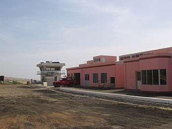
São Filipe Airport (Portuguese: Aeródromo de São Filipe, also: Aeródromo do Fogo) (IATA: SFL, ICAO: GVSF) is Cape Verde's fifth most-used airport, located in the island of Fogo. It is located 2 km southeast of the town of São Filipe, near the Atlantic Ocean. It is used for domestic flights only.
The airport was completed in 1997,[2] replacing a smaller airfield at the same location. Its runway measures 1,350 metres (4,430 ft) by 30 metres (98 ft) wide. The maximum single-wheel load is 20 tonnes.[2]
.jpg)
Airlines and destinations
| Airlines | Destinations |
|---|---|
| Binter CV | Praia |
| Cabo Verde Express | Praia, Sal |
Statistics
| Year | Passengers | Operations | Cargo (t) |
|---|---|---|---|
| 2012 | 74,408 | - | - |
| 2013[3] | 62,088 | 1,756 | 54 |
| 2016[1] | 55,168 | 1,052 | 25.6 |
| 2017[1] | 72,949 | 1,418 | 20.6 |
See also
References
- 1 2 3 "Boletim Estatístico de Tráfego – Ano 2017" (PDF) (in Portuguese). ASA. January 2018. Retrieved 8 August 2018.
- 1 2 Aeródromo do Fogo, Aeroportos e Segurança Aérea (in Portuguese)
- ↑ "Relative Statistics in Airports" (PDF) (in Portuguese). ASA. 1 April 2014. Archived from the original (PDF) on 6 March 2016. Retrieved 17 September 2014.
External links

The island of Fogo | ||
|---|---|---|
| Mosteiros | 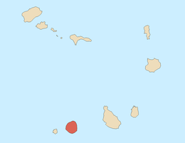 | |
| Santa Catarina do Fogo | ||
| São Filipe | ||
| Other geographical features | ||
| Transportation | ||
| Other topics | ||
This article is issued from
Wikipedia.
The text is licensed under Creative Commons - Attribution - Sharealike.
Additional terms may apply for the media files.