Rukungiri–Kihihi–Ishasha–Kanungu Road
| Rukungiri–Kihihi–Ishasha–Kanungu Road | |
|---|---|
| Route information | |
| Length | 49 mi (79 km) |
| History |
Designation expected in 2016 Completion expected in 2020 |
| Major junctions | |
| East end | Rukungiri |
| Kihihi | |
| West end | Ishasha |
| Highway system | |
| Roads in Uganda | |
Rukungiri–Kihihi–Ishasha–Kanungu Road is a road in southwestern Uganda, connecting the town of Rukungiri in Rukungiri District and the town of Ishasha in Kanungu District, at the International border between Uganda and the Democratic Republic of the Congo. A spur of the road runs south from Kihihi to Kanungu.[1]
Location
The Rukungiri–Kihihi–Ishasha–Kanungu Road starts at Rukungiri, running in a general westward direction. It passes through Kihihi, ending at Ishasha, at the border with DRCongo. A spur of the road runs in a general southern direction from Kihihi to Kanungu. The entire road distance is approximately 79 kilometres (49 mi) with the Rukungiri–Ishasha section measuring 52 kilometres (32 mi) and the Kihihi–Kanungu section measuring 27 kilometres (17 mi).[2] The coordinates of the road near Kihihi in Kanungu District are:0°44'56.0"S, 29°41'53.0"E (Latitude:-0.748889; Longitude:29.698056).[3]
Conversion to bitumen surface
The road, whose total length is 79 kilometres (49 mi), is presently made of unsealed gravel surface. In 2014, the government of Uganda obtained a US$109 million loan to upgrade this and other roads to bituminous surface.[4][5][6] As of November 2014, procurement for a contractor was ongoing.[7]
Landmarks
The following landmarks lie close or near the Rukungiri–Kihihi–Ishasha–Kanungu Road:
- The town of Rukungiri in Rukungiri District, the location of the district headquarters.
- The town of Kihihi in Kanungu District.
- The town of Ishasha, at the International border with DRCongo.
- Queen Elizabeth National Park. The road forms the southern border of the park, in the section between Kihihi and Ishasha.
- The southern spur ends at Kanungu, the location of the headquarters of Kanungu District.
See also
References
- ↑ Oirere, Shem (September 2014). "Two New Road Links Will Help Boost Uganda's Economy". Worldhighways.com. Retrieved 12 July 2015.
- ↑ Lam Kajubi et. al. (11 October 2013). "Environmental And Social Assessment: Resettlement Action Plan (RAP) of Proposed Upgrading Rukungiri–Kihihi–Ishasha/Kanungu Road to Bituminous Standards" (PDF). African Development Bank. Retrieved 12 July 2015.
- ↑ Google (12 July 2015). "Location of Rukungiri–Kihihi–Ishasha–Kanugu Road At Google Maps" (Map). Google Maps. Google. Retrieved 12 July 2015.
- ↑ Vision Reporter, . (4 March 2014). "AfDB To Finance Rukungiri-Ishaka Road Upgrade". New Vision. Kampala. Retrieved 12 July 2015.
- ↑ Kagenda, Patrick (15 June 2014). "AfDB Gives Uganda $109 Million for Roads". The Independent (Uganda). Retrieved 12 July 2015.
- ↑ URN Editorial, . (24 May 2014). "Government Secures Funds for Rukungiri - Kanungu Road". Uganda Radio Network (URN). Retrieved 12 July 2015.
- ↑ Administrator, . (4 November 2014). "UNRA To Begin Works On 16 Roads Next Year". Sunrise.ug. Retrieved 12 July 2015.
External links
Capital: Rukungiri | ||
| Towns and villages |  | |
| Economy | ||
| Transport | ||
| Notable landmarks | ||
| Health |
| |
| Notable people | ||
Capital: Kanungu | ||
| Counties and sub-counties | Kinkinzi County | 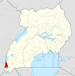 |
| Towns and villages | ||
| Energy | ||
| Economy | ||
| Notable landmarks | ||
| Transport |
| |
| Health | ||
| Education | ||
| Notable people | ||