Kanungu
For information on the "Kanungu tragedy," see Movement for the Restoration of the Ten Commandments of God.
| Kanungu Kanungu Town Council | |
|---|---|
 Kanungu Location in Uganda | |
| Coordinates: 00°53′49″S 29°46′32″E / 0.89694°S 29.77556°E | |
| Country |
|
| Region | Western Region |
| Sub-region | Kigezi sub-region |
| District | Kanungu District |
| Elevation | 4,300 ft (1,310 m) |
| Population (2014 Census) | |
| • Total | 15,138 |
| Climate | Aw |
Kanungu is a town in the Western Region of Uganda. It is the location of the district headquarters for Kanungu District.[1]
Location
Kanungu is located approximately 43 kilometres (27 mi), on a winding dirt road, southwest of the town of Rukungiri, the nearest large town.[2] This location is approximately 404 kilometres (251 mi), by road, southwest of Kampala, the capital and largest city of Uganda.[3] The coordinates of the town are 0°53'49.0"S, 29°46'32.0"E (Latitude:-0.896950; Longitude:29.775556).[4]
Population
The 2014 national population census enumerated the population of Kanungu town at 15,138 inhabitants.[5]
Points of interest
The following additional points of interest lie within Kanungu or near its borders: (a) the offices of Kanungu Town Council[6] (b) Kanungu central market (c) a branch of PostBank Uganda[7] (d) Kanungu Power Station, a 6.6 megawatt hydroelectric power station, also referred to as the "Ishasha Power Station".[8]
Kanungu Town Council is connected to the national electricity grid,[1] and is serviced by National Water and Sewerage Corporation.[9]
See also
References
- 1 2 Ssenkaaba, Stephen (18 November 2013). "Kanungu; Western Uganda's Eyesore". Kampala. Retrieved 11 June 2018.
- ↑ Globefeed.com (11 June 2018). "Distance between Rukungiri Police Central Station, Rukungiri, Uganda and Makiro, Kanungu, Uganda". Globefeed.com. Retrieved 11 June 2018.
- ↑ Globefeed.com (11 June 2018). "Distance between Uganda Post Office, Kampala Road, Kampala, Uganda and Makiro, Kanungu, Uganda". Globefeed.com. Retrieved 11 June 2018.
- ↑ Google (12 July 2015). "Location of Kanungu Town At Google Maps" (Map). Google Maps. Google. Retrieved 12 July 2015.
- ↑ UBOS (November 2014). "National Population and Household Census 2014 Provisional Results Report" (PDF). Kampala: Uganda Bureau of Statistics (UBOS). p. 56. Retrieved 11 June 2018.
- ↑ Muhereza, Robert (21 November 2015). "Kanungu Town Council faces eviction". Daily Monitor. Kampala. Retrieved 11 June 2018.
- ↑ Baraire, Patson (7 November 2010). "Kanungu District Gets Its Second Commercial Bank". New Vision. Kampala. Retrieved 7 June 2014.
- ↑ Rumanzi, Perez (22 November 2011). "Kanungu mini-hydro dam starts work today amid power outages". Daily Monitor. Kampala. Retrieved 11 June 2018.
- ↑ NWSC (31 July 2014). "Area Switch Program for Kanungu/Kihihi Area for Financial Year 2014/2015". Kampala: National Water and Sewerage Corporation (NWSC). Retrieved 11 June 2018.
External links
Capital: Kanungu | ||
| Counties and sub-counties | Kinkinzi County | 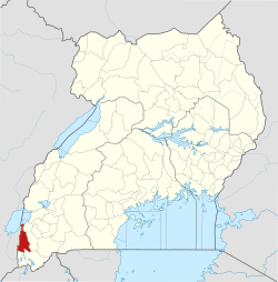 |
| Towns and villages | ||
| Energy | ||
| Economy | ||
| Notable landmarks | ||
| Transport |
| |
| Health | ||
| Education | ||
| Notable people | ||