Rubicon
| Rubicon River | |
|---|---|
 The mouth of the Rubicon in Cesenatico | |
 | |
| Country | Italy |
| Physical characteristics | |
| Main source |
Sogliano al Rubicone 250 m (820 ft) |
| River mouth | Adriatic Sea |
| Length | 80 km (50 mi) |
The Rubicon (Latin: Rubicō, Italian: Rubicone pronounced [rubiˈkone][1]) is a shallow river in northeastern Italy, just south of Ravenna. The same name was given to a river that was famously crossed by Julius Caesar in 49 BC. While it has not been proven, some historians agree that the two rivers are indeed one and the same; this was not always the case.
The modern-day river flows for around 80 km (50 mi) from the Apennine Mountains to the Adriatic Sea through the south of the Emilia-Romagna region, between the towns of Rimini and Cesena. The Latin word Rubicō comes from the adjective rubeus, meaning "red". The river was so named because its waters are colored red by mud deposits.
History
During the Roman republic, the river Rubicon marked the boundary between the Roman province of Cisalpine Gaul to the northeast and Italy proper, controlled directly by Rome and its socii (allies), to the south. On the north-western side, the border was marked by the river Arno, a much wider and more important waterway, which flows westward from the Apennine Mountains (it and the Rubicon rise not far from each other) into the Tyrrhenian Sea.
Governors of Roman provinces were appointed promagistrates with imperium (roughly, "right to command") in their province(s). The governor would then serve as the general of the Roman army within the territory of his province(s). Roman law specified that only the elected magistrates (consuls and praetors) could hold imperium within Italy. Any promagistrate who entered Italy at the head of his troops forfeited his imperium and was therefore no longer legally allowed to command troops.
Exercising imperium when forbidden by the law was a capital offense. Furthermore, obeying the commands of a general who did not legally possess imperium was also a capital offense. If a general entered Italy while exercising command of an army, both the general and his soldiers became outlaws and were automatically condemned to death. Generals were thus obliged to disband their armies before entering Italy.
Julius Caesar
In 49 BC, perhaps on January 10, Julius Caesar led a single legion, Legio XIII Gemina, south over the Rubicon from Cisalpine Gaul to Italy to make his way to Rome. In doing so, he deliberately broke the law on imperium and made armed conflict inevitable. Suetonius depicts Caesar as undecided as he approached the river, and attributes the crossing to a supernatural apparition. It was reported that Caesar dined with Sallust, Hirtius, Oppius, Lucius Balbus and Sulpicus Rufus on the night after his crossing.
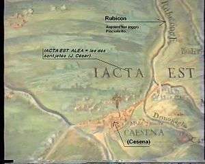
According to Suetonius, Caesar uttered the famous phrase ālea iacta est ("the die has been cast").[2] The phrase "crossing the Rubicon" has survived to refer to any individual or group committing itself irrevocably to a risky or revolutionary course of action, similar to the modern phrase "passing the point of no return". Caesar's decision for swift action forced Pompey, the lawful consuls (C. Claudius Marcellus and L. Cornelius Lentulus Crus), and a large part of the Roman Senate to flee Rome in fear. Caesar's subsequent victory in Caesar's civil war ensured that punishment for the infraction would never be rendered. This took place during the time of the Roman Republic.
Location, confusion and resolution
After Caesar's crossing, the Rubicon was a geographical feature of note until about 42 BC, when Octavian merged the Province of Cisalpine Gaul into Italia and the river ceased to be the extreme northern border of Italy. The decision robbed the Rubicon of its importance, and the name gradually disappeared from the local toponymy.
After the fall of the Western Roman Empire, and during the first centuries of the Middle Ages, the coastal plain between Ravenna and Rimini was flooded many times. The Rubicon, like other small rivers of the region, often changed its course during this period. For this reason, and to supply fields with water after the revival of agriculture in the late Middle Ages, during the 14th and 15th centuries, hydraulic works were built to prevent other floods and to regulate streams. As a result of this work, these rivers started to flow in straight courses, as they do today.
With the revival of interest in the topography of ancient Roman Italy during the 15th century, the matter of identifying the Rubicon in the contemporary landscape became a topic of debate among Renaissance humanists.[3] To support the claim of the Pisciatello, a spurious inscription forbidding the passage of an army in the name of the Roman people and Senate, the so-called Sanctio, was placed by a bridge on that river. The Quattrocento humanist Flavio Biondo was deceived by it;[4] the actual inscription is conserved in the Museo Archeologico, Cesena.[5] As the centuries went by, several rivers of the Adriatic coast between Ravenna and Rimini have at times been said to correspond to the ancient Rubicon.
The Via Aemilia (modern SS 9) still follows its original Roman course as it runs between the hills and the plain; it would have been the obvious course to follow as it was the only major Roman road east of the Apennine Mountains leading to and from the Po Valley. Attempts to deduce the original course of the Rubicon can be made only by studying written documents and other archaeological evidence such as Roman milestones, which indicate the distance between the ancient river and the nearest Roman towns.
The mile zero of a Roman road, from which distances were counted, was always the crossing between the Cardo and the Decumanus, the two principal streets in every Roman town, running north–south and east–west respectively. In a section of the Tabula Peutingeriana, an ancient document showing the network of Roman roads, a river in northeastern Italy labeled "fl. Rubicū" is shown at a position 12 Roman miles (18 km, 11 mi) north of Rimini along the coastline; this is the distance between Rimini and a place called "Ad Confluentes", drawn west of the Rubicon, on the Via Aemilia. However, the river-bed shape observed in Pisciatello and the Rubicone river in the present day, well below Roman-age soil layers, is likely to indicate that any possible course modification of rivers could have occurred only very close to the coastline, and therefore only slight.
Furthermore, the features of the present-day Rubicon river (north–south course, orthogonal to the Via Aemilia) and the Via Aemilia itself (a straight reach before and after the crossing, and a turn just passing by San Giovanni in Compito, so marking a possible administrative boundary) are common to typical geographical oriented limits of Roman age, being what made this a clue of actual identification of the present-day Rubicon River with the Fiumicino.[6]
In 1933, after various efforts that spanned centuries, the Fiumicino, which crossed the town of Savignano di Romagna (now Savignano sul Rubicone), was officially identified as the former Rubicon. Strong evidence supporting this theory came in 1991,[7] when three Italian scholars (Pignotti, Ravagli, and Donati), after a comparison between the Tabula Peutingeriana and other ancient sources (including Cicero), showed that the distance from Rome to the Rubicon River was 200 Roman miles. Key elements of their work are:
- The locality of San Giovanni in Compito (now a western quarter of Savignano) has to be identified with the old Ad Confluentes (compitum means "road junction", and is synonymous with confluentes).
- The distance between Ad Confluentes and Rome, according to the Tabula Peutingeriana, is 201 Roman miles.
- The distance from today's San Giovanni in Compito and the Fiumicino river is 1 Roman mile (1.48 km, 0.92 mi).
Present
.jpg)
Today there is very little evidence of Caesar’s historical passage. Savignano sul Rubicone is an industrial town and the river has become one of the most polluted in the Emilia-Romagna region. Exploitation of underground waters along the upper course of the Rubicon has reduced its flow—it was a minor river even during Roman times (“parvi Rubiconis ad undas” as Lucan said, roughly translated "to the waves of [the] tiny Rubicon")—and has since lost its natural route, except in its upper course between low and woody hills.
Notes
- ↑ ad_NOSPAM_@_NOSPAM_netadcom.com, Progetto informatico, realizzazione tecnica, sitemi di backoffice, hosting: Andrea D'Aquino -. "Dizionario d'ortografia e di pronunzia". www.dizionario.rai.it.
- ↑ Lives of the Caesars, "Divus Julius" sect. 32. Suetonius gives the Latin version, iacta alea est, although, according to Plutarch's Parallel Lives, Caesar quoted a line from the playwright Menander: "ἀνερρίφθω κύβος", anerríphthō kȳbos, "let the die be cast". Suetonius's subtly different translation is often also quoted as alea iacta est. Alea was a game played with a die or dice rather than the actual dice themselves, so another translation might be "The game is afoot."
- ↑ A brief account of the controversies favoring rivers of Romagna, between the Pisciatello, called the Rigone in its lowest reaches, the Fiumicino near Savignano and the Uso is in Dissertazione seconda dell'abate Pasquale Amati savignanese sopra alcune lettere del signor dottor Bianchi di Rimini e sopra il Rubicone degli antichi (Faenza, 1763:6–8), noted in Roberto Weiss, The Renaissance Discovery of Classical Antiquity, 1969:111f and note 9.
- ↑ Biondo, Italia illustrata.
- ↑ Weiss 1969:112 and notes
- ↑ Gianluca Bottazzi (Università di Parma), Le centuriazioni di Ariminum: prospettive di ricerca.
- ↑ Pignotti R., Ravagli P., Donati G., "Rubico quondam finis Italiae", Città del Rubicone, p. 3, October, 1991
External links

- Livius.org: Rubico
- Rubicon in dictionary
- Pearce, M., R. Peretto, P. Tozzi, R. Talbert, T. Elliott, S. Gillies. "Places: 393484 (Rubico fl.)". Pleiades. Retrieved March 8, 2012.
Coordinates: 44°05′35″N 12°23′45″E / 44.093029°N 12.395834°E