Roselawn, Indiana
| Roselawn, Indiana | |
|---|---|
| Census-designated place | |
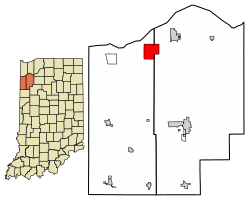 Location of Roselawn in Jasper County and Newton County, Indiana. | |
| Coordinates: 41°9′16″N 87°17′19″W / 41.15444°N 87.28861°WCoordinates: 41°9′16″N 87°17′19″W / 41.15444°N 87.28861°W | |
| Country | United States |
| State | Indiana |
| Counties | Newton, Jasper |
| Townships | Lincoln, Keener |
| Area | |
| • Total | 8.08 sq mi (20.93 km2) |
| • Land | 8.07 sq mi (20.90 km2) |
| • Water | 0.01 sq mi (0.03 km2) |
| Elevation[1] | 682 ft (208 m) |
| Population (2010) | |
| • Total | 4,131 |
| • Density | 512/sq mi (197.7/km2) |
| Time zone | UTC-6 (Central (CST)) |
| • Summer (DST) | UTC-5 (CDT) |
| ZIP code | 46372 |
| Area code(s) | 219 |
| FIPS code | 18-66006[2] |
| GNIS feature ID | 449722 |
Roselawn is a census-designated place (CDP) in Newton and Jasper counties in the U.S. state of Indiana.[3] The population was 4,131 at the 2010 census.[4]
Roselawn is known within northwestern Indiana for the two nudist resorts which operate in this town: the Ponderosa Sun Club and Sun Aura.[5] Sun Aura resort was previously known as Naked City, but closed in 1986 after its operator, Dick Drost, encountered significant legal troubles. The resort continued to operate under several different owners and was known as Sunspot resort prior to becoming Sun Aura. The clubs are long-standing fixtures of the community, dating to the 1930s.[6]
History
Roselawn was laid out in 1882.[7] The community's name is an amalgamation of the names of early merchants Orlando Rose and Lon Craig.[8] A post office has been in operation at Roselawn since 1881.[9]
On October 31, 1994, American Eagle Flight 4184 crashed at Roselawn, killing all 64 passengers and four crew members aboard.[10]
Geography
The original center of Roselawn is in northeastern Newton County, with the CDP extending eastward into northwestern Jasper County. Indiana State Road 10 passes through the community, leading east and north 8 miles (13 km) to DeMotte, and west the same distance to Lake Village. Interstate 65 passes through the eastern part of the community, with access from Exit 230 (State Road 10); I-65 leads north 33 miles (53 km) to Gary and south 58 miles (93 km) to Lafayette.
According to the United States Census Bureau, the Roselawn CDP has a total area of 8.1 square miles (20.9 km2), of which 0.01 square miles (0.03 km2), or 0.15%, are water.[4]
Demographics
| Historical population | |||
|---|---|---|---|
| Census | Pop. | %± | |
| U.S. Decennial Census[11] | |||
As of the census[2] of 2000, there were 3,933 people, 1,286 households, and 1,099 families residing in the CDP. The population density was 484.4 people per square mile (187.0/km²). There were 1,326 housing units at an average density of 163.3/sq mi (63.1/km²). The racial makeup of the CDP was 97.30% White, 0.15% African American, 0.13% Native American, 0.28% Asian, 0.18% Pacific Islander, 0.97% from other races, and 0.99% from two or more races. Hispanic or Latino of any race were 3.33% of the population.
There were 1,286 households out of which 41.4% had children under the age of 18 living with them, 71.7% were married couples living together, 9.2% had a female householder with no husband present, and 14.5% were non-families. 11.7% of all households were made up of individuals and 3.0% had someone living alone who was 65 years of age or older. The average household size was 2.99 and the average family size was 3.22.
In the CDP, the population was spread out with 29.3% under the age of 18, 7.5% from 18 to 24, 29.6% from 25 to 44, 24.7% from 45 to 64, and 8.9% who were 65 years of age or older. The median age was 34 years. For every 100 females, there were 101.3 males. For every 100 females age 18 and over, there were 96.5 males.
The median income for a household in the CDP was $48,625, and the median income for a family was $49,351. Males had a median income of $42,284 versus $18,208 for females. The per capita income for the CDP was $19,136. About 4.3% of families and 3.9% of the population were below the poverty line, including 3.0% of those under age 18 and none of those age 65 or over.
Education
Roselawn has a public library, a branch of the Newton County Public Library.[12]
References
- ↑ "US Board on Geographic Names". United States Geological Survey. 2007-10-25. Retrieved 2008-01-31.
- 1 2 "American FactFinder". United States Census Bureau. Retrieved 2008-01-31.
- ↑ "Roselawn, Indiana". Geographic Names Information System. United States Geological Survey. Retrieved 2017-05-06.
- 1 2 "Geographic Identifiers: 2010 Census Summary File 1 (G001): Roselawn CDP, Indiana". American Factfinder. U.S. Census Bureau. Retrieved May 15, 2018.
- ↑ Roselawn more than its odd notoriety / nwi.com
- ↑ 'Free to be me': Local nudist resort camps no longer are 'best-kept secrets' in their communities / nwi.com
- ↑ Ade, John (1911). Newton County: A Collection of Historical Facts and Personal Recollections Concerning Newton County, Indiana, from 1853 to 1911. Bobbs-Merrill. p. 195.
- ↑ Baker, Ronald L. (October 1995). From Needmore to Prosperity: Hoosier Place Names in Folklore and History. Indiana University Press. p. 286. ISBN 978-0-253-32866-3.
...coined from Rose's last name and Lon Craig's first name.
- ↑ "Newton County". Jim Forte Postal History. Retrieved May 6, 2017.
- ↑ Crash Still Stings / nwi.com
- ↑ "Census of Population and Housing". Census.gov. Retrieved June 4, 2016.
- ↑ "Locations, hours and contacts". Newton County Public Library. Retrieved 11 March 2018.
Municipalities and communities of Newton County, Indiana, United States | ||
|---|---|---|
| Towns | ||
| Townships | ||
| CDPs | ||
| Other unincorporated communities | ||
| Footnotes | ‡This populated place also has portions in an adjacent county or counties | |
Municipalities and communities of Jasper County, Indiana, United States | ||
|---|---|---|
| City | ||
| Towns | ||
| Townships | ||
| CDPs | ||
| Other unincorporated communities | ||
| Footnotes | ‡This populated place also has portions in an adjacent county or counties | |