Keener Township, Jasper County, Indiana
| Keener Township | |
|---|---|
| Township | |
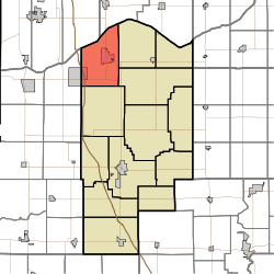 Location in Jasper County | |
| Coordinates: 41°11′23″N 87°12′45″W / 41.18972°N 87.21250°WCoordinates: 41°11′23″N 87°12′45″W / 41.18972°N 87.21250°W | |
| Country | United States |
| State | Indiana |
| County | Jasper |
| Government | |
| • Type | Indiana township |
| Area | |
| • Total | 48.26 sq mi (125.0 km2) |
| • Land | 48.11 sq mi (124.6 km2) |
| • Water | 0.15 sq mi (0.4 km2) 0.31% |
| Elevation | 666 ft (203 m) |
| Population (2010) | |
| • Total | 10,110 |
| • Density | 210.1/sq mi (81.1/km2) |
| GNIS feature ID | 0453522 |
Keener Township is one of thirteen townships in Jasper County, Indiana, United States. As of the 2010 census, its population was 10,110 and it contained 3,977 housing units.[1]
Keener Township was established in 1858.[2]
Geography
According to the 2010 census, the township has a total area of 48.26 square miles (125.0 km2), of which 48.11 square miles (124.6 km2) (or 99.69%) is land and 0.15 square miles (0.39 km2) (or 0.31%) is water.[1]
Cities and towns
Unincorporated towns
Adjacent townships
- Boone Township, Porter County (northeast)
- Walker Township (east)
- Wheatfield Township (east)
- Union Township (south)
- Lincoln Township, Newton County (southwest)
- Eagle Creek Township, Lake County (northwest)
Cemeteries
The township contains three cemeteries: Cemetery of the Resurrection, DeMotte Cemetery, and First Church Cemetery (informally known as Holland Cemetery).
Major highways
Airports and landing strips
- DeMotte Airport
Education
Keener Township residents are eligible to obtain a free library card from the Jasper County Public Library.[3]
References
- "Keener Township, Jasper County, Indiana". Geographic Names Information System. United States Geological Survey. Retrieved 2009-09-24.
- United States Census Bureau cartographic boundary files
- 1 2 "Population, Housing Units, Area, and Density: 2010 - County -- County Subdivision and Place -- 2010 Census Summary File 1". United States Census. Retrieved 2013-05-10.
- ↑ A standard history of Jasper and Newton counties, Indiana. Lewis Publishing Company. 1916. p. 51.
- ↑ "How do I get a library card?". Jasper County Public Library. Retrieved 8 March 2018.
External links
Municipalities and communities of Jasper County, Indiana, United States | ||
|---|---|---|
| City | ||
| Towns | ||
| Townships | ||
| CDPs | ||
| Other unincorporated communities | ||
| Footnotes | ‡This populated place also has portions in an adjacent county or counties | |
This article is issued from
Wikipedia.
The text is licensed under Creative Commons - Attribution - Sharealike.
Additional terms may apply for the media files.