Roppen
| Roppen | ||
|---|---|---|
 | ||
| ||
 Roppen Location within Austria
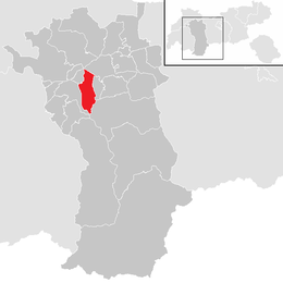
Location in the district
| ||
| Coordinates: 47°13′00″N 10°49′12″E / 47.21667°N 10.82000°ECoordinates: 47°13′00″N 10°49′12″E / 47.21667°N 10.82000°E | ||
| Country | Austria | |
| State | Tyrol | |
| District | Imst | |
| Government | ||
| • Mayor | Ingobert Mayr (SPÖ) | |
| Area | ||
| • Total | 30.86 km2 (11.92 sq mi) | |
| Elevation | 724 m (2,375 ft) | |
| Population (1 January 2016)[1] | ||
| • Total | 1,776 | |
| • Density | 58/km2 (150/sq mi) | |
| Time zone | UTC+1 (CET) | |
| • Summer (DST) | UTC+2 (CEST) | |
| Postal code | 6426 | |
| Area code | 05417 | |
| Vehicle registration | IM | |
| Website | www.roppen.tirol.gv.at | |

Roppen is a municipality in the Imst district and is located 5 km southeast of Imst between the mouths of the Pitze River and the Ötztaler Ache. The village was mentioned in documents in 1260 for the first time as "Roupen" but settlement already began 3000 years ago.
Population
| Historical population | ||
|---|---|---|
| Year | Pop. | ±% |
| 1869 | 656 | — |
| 1880 | 630 | −4.0% |
| 1890 | 592 | −6.0% |
| 1900 | 612 | +3.4% |
| 1910 | 647 | +5.7% |
| 1923 | 653 | +0.9% |
| 1934 | 728 | +11.5% |
| 1939 | 825 | +13.3% |
| 1951 | 883 | +7.0% |
| 1961 | 930 | +5.3% |
| 1971 | 1,118 | +20.2% |
| 1981 | 1,199 | +7.2% |
| 1991 | 1,390 | +15.9% |
| 2001 | 1,605 | +15.5% |
| 2011 | 1,644 | +2.4% |
References
External links
| Wikimedia Commons has media related to Roppen. |
This article is issued from
Wikipedia.
The text is licensed under Creative Commons - Attribution - Sharealike.
Additional terms may apply for the media files.