Karrösten
| Karrösten | ||
|---|---|---|
| ||
 Karrösten Location within Austria
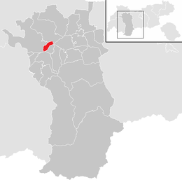
Location in the district
| ||
| Coordinates: 47°13′00″N 10°46′00″E / 47.21667°N 10.76667°ECoordinates: 47°13′00″N 10°46′00″E / 47.21667°N 10.76667°E | ||
| Country | Austria | |
| State | Tyrol | |
| District | Imst | |
| Government | ||
| • Mayor | Oswald Krabacher (ÖVP) | |
| Area | ||
| • Total | 7.91 km2 (3.05 sq mi) | |
| Elevation | 918 m (3,012 ft) | |
| Population (1 January 2016)[1] | ||
| • Total | 678 | |
| • Density | 86/km2 (220/sq mi) | |
| Time zone | UTC+1 (CET) | |
| • Summer (DST) | UTC+2 (CEST) | |
| Postal code | 6463 | |
| Area codes | +43 5412 | |
| Vehicle registration | IM | |
| Website | Gemeinde Karrösten | |

Karrösten is a municipality in the Imst (district) and is located 1.3 km east of Imst. The village was founded because of mining in the 16th century. On the slopes flourishes fruit and maize as well as the sweet chestnut of Tyrol.
Population
| Historical population | ||
|---|---|---|
| Year | Pop. | ±% |
| 1869 | 342 | — |
| 1880 | 325 | −5.0% |
| 1890 | 326 | +0.3% |
| 1900 | 353 | +8.3% |
| 1910 | 358 | +1.4% |
| 1923 | 345 | −3.6% |
| 1934 | 376 | +9.0% |
| 1939 | 405 | +7.7% |
| 1951 | 416 | +2.7% |
| 1961 | 484 | +16.3% |
| 1971 | 500 | +3.3% |
| 1981 | 564 | +12.8% |
| 1991 | 647 | +14.7% |
| 2001 | 685 | +5.9% |
| 2011 | 680 | −0.7% |
References
External links
| Wikimedia Commons has media related to Karrösten. |
This article is issued from
Wikipedia.
The text is licensed under Creative Commons - Attribution - Sharealike.
Additional terms may apply for the media files.