Rooberg
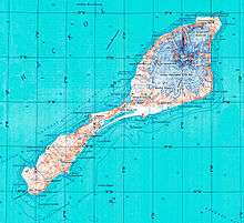
Topographic map of Jan Mayen
Rooberg (English: Red Mountain) is a 50 m (165 ft) hill at Sjuhollendarbukta,[1] a bay on the northwestern coast of the island of Jan Mayen. The hill is often mentioned during the Dutch wintering at Jan Mayen in 1633-34.
References
- ↑ "Rooberg - Ås (Jan Mayen)". Norsk Polarinstitutt (2008-01-01). Retrieved 2013-03-10.
- Norwegian Polar Institute Place Names of Svalbard Database
This article is issued from
Wikipedia.
The text is licensed under Creative Commons - Attribution - Sharealike.
Additional terms may apply for the media files.