Engelskbukta (Jan Mayen)
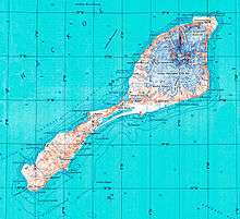
Topographic map of Jan Mayen
Engelskbukta (English: English Bay) is a broad, open bay mid-way up the west coast of the island of Jan Mayen. It lies between Kapp Rudsen and Kvalrossen, comprising Kvalrossbukta and Tømmerbukta. Presumably this is where the English resorted to in 1616, when they sent their first whaling ships to the island. The Dutch also called it Noordbaai (North Bay). The bay was the location of one of the two main Dutch whaling stations in the 17th century. In 1632 two Basque ships landed and plundered the station, causing the Dutch to send a wintering party of seven men in 1633-34. All perished.
References
- Conway, William Martin (1904). Early Dutch and English Voyages to Spitsbergen in the Seventeenth Century. London.
- Norwegian Polar Institute Place Names of Svalbard Database
This article is issued from
Wikipedia.
The text is licensed under Creative Commons - Attribution - Sharealike.
Additional terms may apply for the media files.