Maria Muschbukta
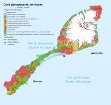
Map of Jan Mayen
Maria Muschbukta (English: Maria Musch Bay) is an open bay between Fulgeberget and Kvalrossen, on the western coast of the island of Jan Mayen.[1] It is named after the shipowner Maria Musch. She was a member of the Kleine Noordse Compagnie, which sent a ship to Jan Mayen in 1616.[1][2] This ship was the first to use the bay to hunt whales. The name is shown on Joan Blaeu's 1662 map of the island.
References
- 1 2 "Maria Muschbukta - Vik (Jan Mayen)". Norsk Polarinstitutt (2008-01-01). Retrieved 2013-03-10.
- ↑ Dalgård (1962), p. 196
- Dalgård, Sune (1962). Dansk-Norsk Hvalfangst 1615-1660: En Studie over Danmark-Norges Stilling i Europæisk Merkantil Expansion. G.E.C Gads Forlag.
- Norwegian Polar Institute Place Names of Svalbard Database
This article is issued from
Wikipedia.
The text is licensed under Creative Commons - Attribution - Sharealike.
Additional terms may apply for the media files.