Roka-kōen Station
Roka-kōen Station 芦花公園駅 | |
|---|---|
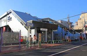 Roka-kōen station. January 2012 | |
| Location |
3-1-16 Minami-Karasuyama, Setagaya, Tokyo (東京都世田谷区南烏山3-1-16) Japan |
| Operated by |
|
| Line(s) | KO Keio Line |
| Connections |
|
| Other information | |
| Station code | KO11 |
| History | |
| Opened | 1913 |
| Previous names | Kami-Takaido (until 1937) |
| Traffic | |
| Passengers (FY2016) | 14,429 daily |
| Location | |
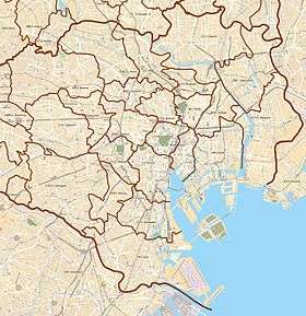 Roka-kōen Station Location within Special wards of Tokyo  Roka-kōen Station Roka-kōen Station (Japan) | |
Roka-kōen Station (芦花公園駅 Roka-kōen-eki) is a railway station on the Keio Line in Setagaya, Tokyo, Japan, operated by the private railway operator Keio Corporation.[1]
The station is named after the nearby Roka Kōshun-en, a park to commemorate Japanese novelist Roka Tokutomi (1868-1927). The park is located approximately one kilometer south of the station.
Station layout
This station has two ground-level side platforms serving two tracks.
Platforms
| 1 | KO Keiō Line | for Chōfu, Keiō Hachiōji KO Keio Takao Line for Takaosanguchi KO Keio Sagamihara Line for Hashimoto |
| 2 | KO Keiō Line | for Meidaimae, Sasazuka, and Shinjuku KO Keio New Line for Shinjuku S Toei Shinjuku Line for Motoyawata |
Adjacent stations
| ← | Service | → | ||
|---|---|---|---|---|
| Keio Line | ||||
| Keiō Liner: Does not stop at this station | ||||
| Special Express: Does not stop at this station | ||||
| Semi Special Express: Does not stop at this station | ||||
| Express: Does not stop at this station | ||||
| Semi Express: Does not stop at this station | ||||
| Rapid: Does not stop at this station | ||||
| Hachimanyama | Local | Chitose-Karasuyama | ||
History
The station opened on April 15, 1913, initially named Kami-Takaido Station (上高井戸駅).[2] It was renamed on September 1, 1937.[2]
References
| Wikimedia Commons has media related to Roka-kōen Station. |
- ↑ Keio Railway Map
- 1 2 Terada, Hirokazu (19 January 2013). データブック日本の私鉄 [Databook: Japan's Private Railways]. Japan: Neko Publishing. p. 228. ISBN 978-4-7770-1336-4.
Coordinates: 35°40′13″N 139°36′29″E / 35.6704°N 139.6081°E
This article is issued from
Wikipedia.
The text is licensed under Creative Commons - Attribution - Sharealike.
Additional terms may apply for the media files.