Roggenburg, Bavaria
| Roggenburg | ||
|---|---|---|
| ||
 Roggenburg Location of Roggenburg within Neu-Ulm district 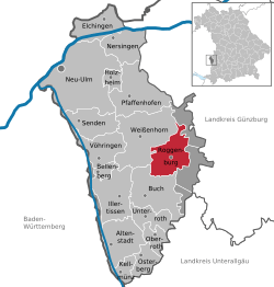 | ||
| Coordinates: 48°16′N 10°13′E / 48.267°N 10.217°ECoordinates: 48°16′N 10°13′E / 48.267°N 10.217°E | ||
| Country | Germany | |
| State | Bavaria | |
| Admin. region | Schwaben | |
| District | Neu-Ulm | |
| Government | ||
| • Mayor | Franz-Clemens Brechtel | |
| Area | ||
| • Total | 27.41 km2 (10.58 sq mi) | |
| Elevation | 512 m (1,680 ft) | |
| Population (2017-12-31)[1] | ||
| • Total | 2,682 | |
| • Density | 98/km2 (250/sq mi) | |
| Time zone | CET/CEST (UTC+1/+2) | |
| Postal codes | 89297 | |
| Dialling codes | 07300 | |
| Vehicle registration | NU | |
| Website | www.roggenburg.de | |

Roggenburg is a municipality in the district of Neu-Ulm in Bavaria in Germany.
Roggenburg is known for the Roggenburg Abbey, which is used today by the Premonstratensians. An environment and culture center with an overregional commuting area is located near the abbey.
Geographical location
The municipality lies in the region "Donau-Iller" in central Swabia, approximately 30 km southeast of Ulm and 40 km north of Memmingen. The districts Roggenburg, Biberach and Meßhofen are located on the Biber river, the districts Ingstetten, Schießen and Unteregg at the Osterbach, while Schleebuch is located between these two rivers.

Biberach around 1900
Politics
Local council
The council has 14 members plus the major.
| ÜWV Schießen | FW Meßhofen/Roggenburg | WG Biberach | WG Ingstetten | Total | |
| 2002 | 5 | 3 | 4 | 2 | 14 seats |
External links
| Wikimedia Commons has media related to Roggenburg. |
- "Roggenburg, Bavaria: History of the coat-of-arms" (in German). Haus der Bayerischen Geschichte.
- Official statistics
Towns and municipalities in Neu-Ulm (district) | ||
|---|---|---|
References
- ↑ "Fortschreibung des Bevölkerungsstandes". Bayerisches Landesamt für Statistik und Datenverarbeitung (in German). September 2018.
This article is issued from
Wikipedia.
The text is licensed under Creative Commons - Attribution - Sharealike.
Additional terms may apply for the media files.