Altenstadt, Swabia
| Altenstadt | ||
|---|---|---|
| ||
 Altenstadt Location of Altenstadt within Neu-Ulm district 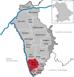 | ||
| Coordinates: 48°10′N 10°07′E / 48.167°N 10.117°ECoordinates: 48°10′N 10°07′E / 48.167°N 10.117°E | ||
| Country | Germany | |
| State | Bavaria | |
| Admin. region | Schwaben | |
| District | Neu-Ulm | |
| Municipal assoc. | Altenstadt (Schwaben) | |
| Government | ||
| • Mayor | Wolfgang Höß (CSU) | |
| Area | ||
| • Total | 31.30 km2 (12.08 sq mi) | |
| Elevation | 530 m (1,740 ft) | |
| Population (2017-12-31)[1] | ||
| • Total | 5,057 | |
| • Density | 160/km2 (420/sq mi) | |
| Time zone | CET/CEST (UTC+1/+2) | |
| Postal codes | 89281 | |
| Dialling codes | 08337 | |
| Vehicle registration | NU, ILL | |
| Website | www.altenstadt-vg.de | |

Altenstadt is a municipality in the district of Neu-Ulm in Bavaria in Germany.
The municipality is located in middle Swabia in the valley of the Iller, about 30 km south of Ulm and 25 km north of Memmingen.
Districts
Altenstadt is arranged into 7 districts. The districts are:
- Altenstadt
- Bergenstetten
- Dattenhausen
- Filzingen
- Herrenstetten
- Illereichen
- Untereichen
Sights
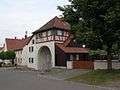 Torhaus, Illereichen
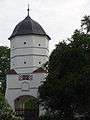 Tower of a former castle complex
See also
- Synagogues of the Swabian type (Altenstadt)
References
- ↑ "Fortschreibung des Bevölkerungsstandes". Bayerisches Landesamt für Statistik und Datenverarbeitung (in German). September 2018.
External links
| Wikimedia Commons has media related to Altenstadt. |
- Official website
- "Altenstadt, Swabia: History of the coat-of-arms" (in German). Haus der Bayerischen Geschichte.
- Altenstadt, Swabia: Official statistics compiled by the Bavarian State Office of Statistics (LfStat)
Towns and municipalities in Neu-Ulm (district) | ||
|---|---|---|
This article is issued from
Wikipedia.
The text is licensed under Creative Commons - Attribution - Sharealike.
Additional terms may apply for the media files.