Rogers, Virginia
| Rogers | |
|---|---|
| Unincorporated community | |
 Rogers  Rogers  Rogers | |
| Coordinates: 37°5′16″N 80°23′49″W / 37.08778°N 80.39694°WCoordinates: 37°5′16″N 80°23′49″W / 37.08778°N 80.39694°W | |
| Country | United States |
| State | Virginia |
| County | Montgomery |
| Elevation | 1,824 ft (556 m) |
| Time zone | UTC−5 (Eastern (EST)) |
| • Summer (DST) | UTC−4 (EDT) |
| GNIS feature ID | 1473503[1] |
Rogers is an unincorporated community in Montgomery County, Virginia,[1] south of the county seat of Christiansburg. It is part of the Blacksburg–Christiansburg–Radford Metropolitan Statistical Area, which encompasses all of Montgomery County and the city of Radford.
Rogers is located at the intersection of Pilot Road (VA 615) and Elliot's Creek Road (VA 675). It also includes the intersection of Nolley Road and Pilot Road. Elliot's Creek Road, (VA 675) is the historic road that connected Shawsville to Riner in the lower half of Montgomery County. The historic Shawsville to Riner Road is now represented by modern-day Allegheny Springs Road, Split Rail Road, Elliot's Creek Road, Nolley Road, and Union Valley Road.
References
- 1 2 "Rogers". Geographic Names Information System. United States Geological Survey. Retrieved February 26, 2014.
Municipalities and communities of Montgomery County, Virginia, United States | ||
|---|---|---|
| Towns | 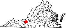 | |
| CDPs | ||
| Unincorporated communities | ||
| Footnotes | ‡This populated place also has portions in an adjacent county or counties | |
This article is issued from
Wikipedia.
The text is licensed under Creative Commons - Attribution - Sharealike.
Additional terms may apply for the media files.