New Ellett, Virginia
| New Ellett, Virginia | |
|---|---|
| Unincorporated community | |
 National Register of Historic Places at New Ellett, Virginia
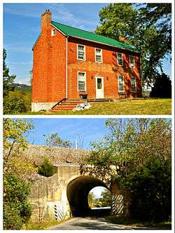
Top: George Earhart House Bottom: Virginian Railway Underpass | |
 New Ellett, Virginia  New Ellett, Virginia | |
| Coordinates: 37°11′58″N 80°21′48″W / 37.19944°N 80.36333°WCoordinates: 37°11′58″N 80°21′48″W / 37.19944°N 80.36333°W | |
| Country | United States |
| State | Virginia |
| County | Montgomery |
| Elevation | 1,549 ft (472 m) |
| Time zone | UTC-5 (Eastern (EST)) |
| • Summer (DST) | UTC-4 (EDT) |
| Area code(s) | 540 |
| GNIS feature ID | 1495999[1] |
New Ellett is an unincorporated community in Montgomery County, Virginia, United States. New Ellett is located on State Route 723 3.5 miles (5.6 km) southeast of Blacksburg.
The George Earhart House and Virginian Railway Underpass are listed on the National Register of Historic Places.[2]
References
- ↑ "New Ellett". Geographic Names Information System. United States Geological Survey.
- ↑ National Park Service (2010-07-09). "National Register Information System". National Register of Historic Places. National Park Service.
Municipalities and communities of Montgomery County, Virginia, United States | ||
|---|---|---|
| Towns |  | |
| CDPs | ||
| Unincorporated communities | ||
| Footnotes | ‡This populated place also has portions in an adjacent county or counties | |
This article is issued from
Wikipedia.
The text is licensed under Creative Commons - Attribution - Sharealike.
Additional terms may apply for the media files.