Rocky Hill, New Jersey
| Rocky Hill, New Jersey | |
|---|---|
| Borough | |
| Borough of Rocky Hill | |
 First Reformed Church, built 1856, at the heart of the Rocky Hill Historic District | |
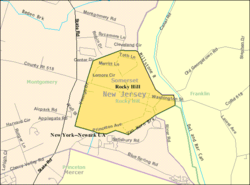
 Map of Rocky Hill in Somerset County. Inset: Location of Somerset County highlighted in the State of New Jersey. | |
 Census Bureau map of Rocky Hill, New Jersey | |
| Coordinates: 40°24′01″N 74°38′20″W / 40.400348°N 74.638922°WCoordinates: 40°24′01″N 74°38′20″W / 40.400348°N 74.638922°W[1][2] | |
| Country |
|
| State |
|
| County | Somerset |
| Incorporated | December 18, 1889 |
| Government[3] | |
| • Type | Borough |
| • Body | Borough Council |
| • Mayor | Jeff Donahue (I, term ends December 31, 2018)[4][5] |
| • Municipal clerk | Rebecca P. Newman[6] |
| Area[1] | |
| • Total | 0.622 sq mi (1.612 km2) |
| • Land | 0.619 sq mi (1.604 km2) |
| • Water | 0.003 sq mi (0.008 km2) 0.52% |
| Area rank |
537th of 566 in state 21st of 21 in county[1] |
| Elevation[7] | 108 ft (33 m) |
| Population (2010 Census)[8][9][10] | |
| • Total | 682 |
| • Estimate (2016)[11] | 688 |
| • Rank |
548th of 566 in state 20th of 21 in county[12] |
| • Density | 1,101.4/sq mi (425.3/km2) |
| • Density rank |
370th of 566 in state 11th of 21 in county[12] |
| Time zone | UTC-5 (Eastern (EST)) |
| • Summer (DST) | UTC-4 (Eastern (EDT)) |
| ZIP code | 08553[13][14] |
| Area code(s) | 609 Exchanges: 252, 279, 430, 921, 924[15] |
| FIPS code | 3403564320[1][16][17] |
| GNIS feature ID | 0885376[1][18] |
| Website |
www |
Rocky Hill is a borough in Somerset County, New Jersey, United States, named for the Rocky Hill Ridge. Before roads were improved and people traveled by automobiles, it was known as the Devil's Featherbed because it was difficult to travel the rocky terrain by horse and wagon.[19]
As of the 2010 United States Census, the rural borough's population was 682,[8][9][10] reflecting an increase of 20 (+3.0%) from the 662 counted in the 2000 Census. This was a decline of 31 persons (-4.5%) from the 693 counted in the 1990 Census.[20]
Rocky Hill was incorporated as a borough by an act of the New Jersey Legislature on December 18, 1889, from portions of Montgomery Township, based on the results of a referendum held four days earlier.[21]
Geography
According to the United States Census Bureau, the borough had a total area of 0.622 square miles (1.612 km2), including 0.619 square miles (1.604 km2) of land and 0.003 square miles (0.008 km2) of water (0.52%).[1][2]
The borough borders the Somerset County municipalities of Franklin Township and Montgomery Township.[22]
Demographics
| Historical population | |||
|---|---|---|---|
| Census | Pop. | %± | |
| 1900 | 354 | — | |
| 1910 | 502 | 41.8% | |
| 1920 | 305 | −39.2% | |
| 1930 | 512 | 67.9% | |
| 1940 | 404 | −21.1% | |
| 1950 | 537 | 32.9% | |
| 1960 | 528 | −1.7% | |
| 1970 | 917 | 73.7% | |
| 1980 | 717 | −21.8% | |
| 1990 | 693 | −3.3% | |
| 2000 | 662 | −4.5% | |
| 2010 | 682 | 3.0% | |
| Est. 2016 | 688 | [11][23] | 0.9% |
| Population sources: 1900-1920[24] 1900-1910[25] 1910-1930[26] 1930-1990[27] 2000[28][29] 2010[8][9][10] | |||
Census 2010
As of the 2010 United States Census, there were 682 people, 280 households, and 189 families residing in the borough. The population density was 1,101.4 per square mile (425.3/km2). There were 292 housing units at an average density of 471.6 per square mile (182.1/km2). The racial makeup of the borough was 91.64% (625) White, 1.47% (10) Black or African American, 0.00% (0) Native American, 2.35% (16) Asian, 0.00% (0) Pacific Islander, 1.47% (10) from other races, and 3.08% (21) from two or more races. Hispanic or Latino of any race were 4.84% (33) of the population.[8]
There were 280 households out of which 29.3% had children under the age of 18 living with them, 56.4% were married couples living together, 8.6% had a female householder with no husband present, and 32.5% were non-families. 26.4% of all households were made up of individuals, and 8.2% had someone living alone who was 65 years of age or older. The average household size was 2.40 and the average family size was 2.95.[8]
In the borough, the population was spread out with 23.2% under the age of 18, 4.7% from 18 to 24, 21.3% from 25 to 44, 32.4% from 45 to 64, and 18.5% who were 65 years of age or older. The median age was 45.9 years. For every 100 females there were 103.0 males. For every 100 females ages 18 and older there were 91.2 males.[8]
The Census Bureau's 2006-2010 American Community Survey showed that (in 2010 inflation-adjusted dollars) median household income was $88,929 (with a margin of error of +/- $14,448) and the median family income was $102,917 (+/- $21,668). Males had a median income of $88,333 (+/- $16,491) versus $57,083 (+/- $7,607) for females. The per capita income for the borough was $47,582 (+/- $7,276). About 0.0% of families and 3.3% of the population were below the poverty line, including 0.0% of those under age 18 and 0.0% of those age 65 or over.[30]
Census 2000
As of the 2000 United States Census[16] there were 662 people, 284 households, and 189 families residing in the borough. The population density was 982.0 people per square mile (381.5/km2). There were 295 housing units at an average density of 437.6 per square mile (170.0/km2). The racial makeup of the borough was 95.17% White, 1.36% African American, 0.45% Asian, 0.60% Pacific Islander, 0.91% from other races, and 1.51% from two or more races. Hispanic or Latino of any race were 3.93% of the population.[28][29]
There were 284 households out of which 24.3% had children under the age of 18 living with them, 60.9% were married couples living together, 4.9% had a female householder with no husband present, and 33.1% were non-families. 27.8% of all households were made up of individuals and 12.7% had someone living alone who was 65 years of age or older. The average household size was 2.33 and the average family size was 2.82.[28][29]
In the borough the population was spread out with 20.2% under the age of 18, 3.3% from 18 to 24, 28.1% from 25 to 44, 31.1% from 45 to 64, and 17.2% who were 65 years of age or older. The median age was 44 years. For every 100 females, there were 98.2 males. For every 100 females age 18 and over, there were 95.6 males.[28][29]
The median income for a household in the borough was $79,469, and the median income for a family was $100,314. Males had a median income of $54,375 versus $50,357 for females. The per capita income for the borough was $48,357. About 2.5% of families and 2.7% of the population were below the poverty line, including 1.8% of those under age 18 and 5.3% of those age 65 or over.[28][29]
Government
Local government
Rocky Hill is governed under the Borough form of New Jersey municipal government. The governing body consists of a Mayor and a Borough Council comprising six council members, with all positions elected at-large on a partisan basis as part of the November general election. A Mayor is elected directly by the voters to a four-year term of office. The Borough Council consists of six members elected to serve three-year terms on a staggered basis, with two seats coming up for election each year in a three-year cycle.[3] The Borough form of government used by Rocky Hill, the most common system used in the state, is a "weak mayor / strong council" government, in which council members act as the legislative body. The mayor presides at meetings and votes only in the event of a tie. The mayor can veto ordinances subject to an override by a two-thirds majority vote of the council. The mayor makes committee and liaison assignments for council members, and most appointments are made by the mayor with the advice and consent of the council.[31][32]
As of 2016, the Mayor of Rocky Hill is Independent Jeffrey Donahue, whose term of office ends December 31, 2018. Members of the Borough Council are Council President Thomas Bremner (I, 2016), Robert L. Ashbaugh (I, 2018), William "Billy" Dawson (D, 2017), John C. Hagemann (R, 2018), Philip Kartsonis (I, 2016) and Robert Uhrik (D, 2017).[4][33][34][35][36][37]
At the January 2015 Reorganization Meeting, the Borough Council selected Robert Ashbaugh to fill the vacant seat expiring in December 2015 of Jeffrey Donohue, who vacated the seat when he took office as mayor.[38]
Federal, state and county representation
Rocky Hill is located in the 7th Congressional District[39] and is part of New Jersey's 16th state legislative district.[9][40][41]
New Jersey's Seventh Congressional District is represented by Leonard Lance (R, Clinton Township).[42] New Jersey is represented in the United States Senate by Democrats Cory Booker (Newark, term ends 2021)[43] and Bob Menendez (Paramus, 2019).[44][45]
For the 2018–2019 session (Senate, General Assembly), the 16th Legislative District of the New Jersey Legislature is represented in the State Senate by Christopher Bateman (R, Branchburg) and in the General Assembly by Andrew Zwicker (D, South Brunswick) and Roy Freiman (D, Hillsborough Township).[46][47] The Governor of New Jersey is Phil Murphy (D, Middletown Township).[48] The Lieutenant Governor of New Jersey is Sheila Oliver (D, East Orange).[49]
Somerset County is governed by a five-member Board of Chosen Freeholders, whose members are elected at-large to three-year terms of office on a staggered basis, with one or two seats coming up for election each year. At an annual reorganization meeting held in the beginning of January, the board selects a Director and Deputy Director from among its members.[50] As of 2018, Somerset County's Freeholders are Freeholder Director Patrick Scaglione (R, Bridgewater Township, term as freeholder and as freeholder director ends December 31, 2018),[51] Freeholder Deputy Director Brian D. Levine (R, Franklin Township, term as freeholder ends 2020; term as freeholder deputy director ends 2018),[52] Mark Caliguire (R, Skillman in Montgomery Township, 2018),[53] Brian G. Gallagher (R, Somerville, 2020)[54] and Patricia L. Walsh (R, Green Brook Township, 2019).[55][56] Constitutional officers elected on a countywide basis are County Clerk Steve Peter (D, Somerville, 2022),[57] Sheriff Frank J. Provenzano (R, Raritan, 2019)[58] and Surrogate Frank Bruno (R, Branchburg, 2020).[59]
Politics
As of March 23, 2011, there were a total of 527 registered voters in Rocky Hill, of which 183 (34.7% vs. 26.0% countywide) were registered as Democrats, 190 (36.1% vs. 25.7%) were registered as Republicans and 151 (28.7% vs. 48.2%) were registered as Unaffiliated. There were 3 voters registered to other parties.[60] Among the borough's 2010 Census population, 77.3% (vs. 60.4% in Somerset County) were registered to vote, including 100.6% of those ages 18 and over (vs. 80.4% countywide).[60][61]
In the 2012 presidential election, Democrat Barack Obama received 63.6% of the vote (252 cast), ahead of Republican Mitt Romney with 34.6% (137 votes), and other candidates with 1.8% (7 votes), among the 397 ballots cast by the borough's 532 registered voters (1 ballot was spoiled), for a turnout of 74.6%.[62][63] In the 2008 presidential election, Democrat Barack Obama received 258 votes (61.0% vs. 52.1% countywide), ahead of Republican John McCain with 154 votes (36.4% vs. 46.1%) and other candidates with 8 votes (1.9% vs. 1.1%), among the 423 ballots cast by the borough's 511 registered voters, for a turnout of 82.8% (vs. 78.7% in Somerset County).[64] In the 2004 presidential election, Democrat John Kerry received 241 votes (56.3% vs. 47.2% countywide), ahead of Republican George W. Bush with 181 votes (42.3% vs. 51.5%) and other candidates with 6 votes (1.4% vs. 0.9%), among the 428 ballots cast by the borough's 501 registered voters, for a turnout of 85.4% (vs. 81.7% in the whole county).[65]
In the 2013 gubernatorial election, Republican Chris Christie received 54.0% of the vote (150 cast), ahead of Democrat Barbara Buono with 42.8% (119 votes), and other candidates with 3.2% (9 votes), among the 282 ballots cast by the borough's 535 registered voters (4 ballots were spoiled), for a turnout of 52.7%.[66][67] In the 2009 gubernatorial election, Republican Chris Christie received 153 votes (50.2% vs. 55.8% countywide), ahead of Democrat Jon Corzine with 122 votes (40.0% vs. 34.1%), Independent Chris Daggett with 23 votes (7.5% vs. 8.7%) and other candidates with 2 votes (0.7% vs. 0.7%), among the 305 ballots cast by the borough's 522 registered voters, yielding a 58.4% turnout (vs. 52.5% in the county).[68]
Education
Rocky Hill is a non-operating school district. All public school students from the Rocky Hill School District attend school in the Montgomery Township School District, in Montgomery Township as part of a sending/receiving relationship.[69][70] As of the 2012-13 school year, the district's five schools had an enrollment of 5,045 students and 378.3 classroom teachers (on an FTE basis), for a student–teacher ratio of 13.34:1.[71] Schools in the district (with 2012-13 enrollment data from the National Center for Education Statistics[72]) are Orchard Hill Elementary School[73] (grades K-2; 844 students), Village Elementary School[74] (3-4; 682), Montgomery Lower Middle School[75] (5-6; 794), Montgomery Upper Middle School[76] (7-8; 822) and Montgomery High School[77] (9-12; 1,740).[78][79][80]
Rocky Hill is home to the Rocky Hill Cooperative Nursery School, which was established in 1957.[81]
Transportation
Roads and highways
As of May 2010, the borough had a total of 4.38 miles (7.05 km) of roadways, of which 2.88 miles (4.63 km) were maintained by the municipality and 1.50 miles (2.41 km) by Somerset County.[82]
The major road that passes through is County Route 518, which provides access to U.S. Route 206 to the west and Route 27 to the east. The nearest limited access roads are at least 25 minutes away, such as Interstate 287, Interstate 295 and the New Jersey Turnpike (Interstate 95).
Airport
Princeton Airport, serving the neighboring town of Princeton, is located in Montgomery Township, just west of Rocky Hill.
Emergency services
Police coverage is provided by the New Jersey State Police, from the Kingwood Station in Hunterdon County. Part-time coverage is provided by the South Bound Brook Police for traffic enforcement only.[83]
Fire protection is offered by the Rocky Hill Hook & Ladder Co #1/Station 53 Fire.[84]
Emergency Medical Services are provided by the Rocky Hill First Aid and Rescue Squad (53 Rescue), which had been temporarily decommissioned as of March 2011 by Resolution 2011-33.[85] An aggressive recruitment and training program under new operational and executive leadership led to Rocky Hill First and Rescue Squad returning to full primary EMS coverage in October 2012, covering all shifts on a scramble basis and offering mutual aid to squads based in Franklin Township, Kingston, and Princeton.[86]
Notable people
People who were born in, residents of, or otherwise closely associated with Rocky Hill include:
- John M. Berrien (1781–1856), served as United States Attorney General and represented Georgia in the United States Senate.[87]
- George Washington stayed in Rockingham, the house of the Berrien family, in the late summer of 1783, while Congress was in session in Princeton. The site was then located along the Stonybrook in Rocky Hill, and presently gives tours.
References
- 1 2 3 4 5 6 2010 Census Gazetteer Files: New Jersey County Subdivisions, United States Census Bureau. Accessed May 21, 2015.
- 1 2 US Gazetteer files: 2010, 2000, and 1990, United States Census Bureau. Accessed September 4, 2014.
- 1 2 2012 New Jersey Legislative District Data Book, Rutgers University Edward J. Bloustein School of Planning and Public Policy, March 2013, p. 77.
- 1 2 Borough Council - 2015, Borough of Rocky Hill. Accessed August 1, 2016.
- ↑ 2017 New Jersey Mayors Directory, New Jersey Department of Community Affairs. Accessed May 30, 2017.
- ↑ Municipal Office, Borough of Rocky Hill. Accessed August 1, 2016.
- ↑ U.S. Geological Survey Geographic Names Information System: Borough of Rocky Hill, Geographic Names Information System. Accessed March 11, 2013.
- 1 2 3 4 5 6 DP-1 - Profile of General Population and Housing Characteristics: 2010 for Rocky Hill borough, Somerset County, New Jersey, United States Census Bureau. Accessed February 14, 2013.
- 1 2 3 4 Municipalities Grouped by 2011-2020 Legislative Districts, New Jersey Department of State, p. 8. Accessed January 6, 2013.
- 1 2 3 Profile of General Demographic Characteristics: 2010 for Rocky Hill borough, New Jersey Department of Labor and Workforce Development. Accessed February 14, 2013.
- 1 2 PEPANNRES - Annual Estimates of the Resident Population: April 1, 2010 to July 1, 2016 - 2016 Population Estimates for New Jersey municipalities, United States Census Bureau. Accessed June 16, 2017.
- 1 2 GCT-PH1 Population, Housing Units, Area, and Density: 2010 - State -- County Subdivision from the 2010 Census Summary File 1 for New Jersey, United States Census Bureau. Accessed February 14, 2013.
- ↑ Look Up a ZIP Code for Rocky Hill, NJ, United States Postal Service. Accessed February 14, 2013.
- ↑ Zip Codes, State of New Jersey. Accessed August 29, 2013.
- ↑ Area Code Lookup - NPA NXX for Rocky Hill, NJ, Area-Codes.com. Accessed August 29, 2013.
- 1 2 American FactFinder, United States Census Bureau. Accessed September 4, 2014.
- ↑ A Cure for the Common Codes: New Jersey, Missouri Census Data Center. Accessed October 29, 2012.
- ↑ US Board on Geographic Names, United States Geological Survey. Accessed September 4, 2014.
- ↑ Rocky Hill Heritage Day
- ↑ Table 7. Population for the Counties and Municipalities in New Jersey: 1990, 2000 and 2010 Archived 2013-05-20 at the Wayback Machine., New Jersey Department of Labor and Workforce Development, February 2011. Accessed February 14, 2013.
- ↑ Snyder, John P. The Story of New Jersey's Civil Boundaries: 1606-1968, Bureau of Geology and Topography; Trenton, New Jersey; 1969. p. 225. Accessed October 23, 2012.
- ↑ Areas touching Rocky Hill, MapIt. Accessed February 3, 3015.
- ↑ Census Estimates for New Jersey April 1, 2010 to July 1, 2016, United States Census Bureau. Accessed June 16, 2017.
- ↑ Compendium of censuses 1726-1905: together with the tabulated returns of 1905, New Jersey Department of State, 1906. Accessed July 18, 2013.
- ↑ Thirteenth Census of the United States, 1910: Population by Counties and Minor Civil Divisions, 1910, 1900, 1890, United States Census Bureau, p. 338. Accessed February 14, 2013.
- ↑ Fifteenth Census of the United States : 1930 - Population Volume I, United States Census Bureau, p. 718. Accessed February 14, 2013.
- ↑ Table 6. New Jersey Resident Population by Municipality: 1930 - 1990 Archived 2015-05-10 at the Wayback Machine., New Jersey Department of Labor and Workforce Development. Accessed June 28, 2015.
- 1 2 3 4 5 Census 2000 Profiles of Demographic / Social / Economic / Housing Characteristics for Rocky Hill borough, New Jersey, United States Census Bureau. Accessed February 14, 2013.
- 1 2 3 4 5 DP-1: Profile of General Demographic Characteristics: 2000 - Census 2000 Summary File 1 (SF 1) 100-Percent Data for Rocky Hill borough, Somerset County, New Jersey, United States Census Bureau. Accessed February 14, 2013.
- ↑ DP03: Selected Economic Characteristics from the 2006-2010 American Community Survey 5-Year Estimates for Rocky Hill borough, Somerset County, New Jersey, United States Census Bureau. Accessed February 14, 2013.
- ↑ Cerra, Michael F. "Forms of Government: Everything You've Always Wanted to Know, But Were Afraid to Ask" Archived 2014-09-24 at the Wayback Machine., New Jersey State League of Municipalities. Accessed November 30, 2014.
- ↑ "Forms of Municipal Government in New Jersey", p. 6. Rutgers University Center for Government Studies. Accessed June 3, 2015.
- ↑ 2016 Municipal User Friendly Budget, Borough of Rocky Hill. Accessed August 1, 2016.
- ↑ Somerset County Directory 2016, Somerset County, New Jersey. Accessed July 31, 2016.
- ↑ Somerset County - General Election November 3, 2015 Winning Candidates, Somerset County, New Jersey. Accessed July 31, 2016.
- ↑ Somerset County - General Election November 4, 2014 Winning Candidates, Somerset County, New Jersey. Accessed July 31, 2016.
- ↑ Somerset County - General Election November 5, 2013 Winning Candidates, Somerset County, New Jersey. Accessed July 31, 2016.
- ↑ Minutes of the Reorganization / Regular Meeting January 1, 2015, Borough of Rocky Hill. Accessed August 20, 2015. "Mayor Donohue recommended the nomination of Robert Ashbaugh to fill the Council vacancy for the remainder of his term. Hallman moved to nominate Robert Ashbaugh to full the open Council seat with a term expiring December 31, 2015. Bremner seconded the motion, and the motion carried on a roll call vote."
- ↑ Plan Components Report, New Jersey Redistricting Commission, December 23, 2011. Accessed January 6, 2013.
- ↑ 2017 New Jersey Citizen's Guide to Government Archived 2017-04-07 at the Wayback Machine., p. 63, New Jersey League of Women Voters. Accessed May 30, 2017.
- ↑ Districts by Number for 2011-2020, New Jersey Legislature. Accessed January 6, 2013.
- ↑ Directory of Representatives: New Jersey, United States House of Representatives. Accessed January 5, 2012.
- ↑ About Cory Booker, United States Senate. Accessed January 26, 2015. "He now owns a home and lives in Newark's Central Ward community."
- ↑ Biography of Bob Menendez, United States Senate, January 26, 2015. "He currently lives in Paramus and has two children, Alicia and Robert."
- ↑ Senators of the 114th Congress from New Jersey. United States Senate. Accessed January 26, 2015. "Booker, Cory A. - (D - NJ) Class II; Menendez, Robert - (D - NJ) Class I"
- ↑ Legislative Roster 2018-2019 Session, New Jersey Legislature. Accessed January 22, 2018.
- ↑ District 16 Legislators, New Jersey Legislature. Accessed January 22, 2018.
- ↑ Governor Phil Murphy, State of New Jersey. Accessed January 16, 2018.
- ↑ Lieutenant Governor Oliver, State of New Jersey. Accessed January 16, 2018. "Assemblywoman Oliver has resided in the City of East Orange for over 40 years."
- ↑ Elected Officials, Somerset County, New Jersey. Accessed February 24, 2018.
- ↑ Patrick Scaglione, Director, Somerset County, New Jersey. Accessed February 24, 2018.
- ↑ Brian D. Levine, Freeholder Deputy Director, Somerset County, New Jersey. Accessed February 24, 2018.
- ↑ Mark Caliguire, Freeholder, Somerset County, New Jersey. Accessed February 24, 2018.
- ↑ Brian G. Gallagher, Freeholder, Somerset County, New Jersey. Accessed February 24, 2018.
- ↑ Patricia L. Walsh, Freeholder, Somerset County, New Jersey. Accessed February 24, 2018.
- ↑ Board of Chosen Freeholders, Somerset County, New Jersey. Accessed February 24, 2018.
- ↑ Steve Peter, County Clerk, Somerset County, New Jersey. Accessed February 24, 2018.
- ↑ Frank J. Provenzano, Sr., Sheriff, Somerset County, New Jersey. Accessed February 24, 2018.
- ↑ Frank Bruno, Surrogate, Somerset County, New Jersey. Accessed February 24, 2018.
- 1 2 Voter Registration Summary - Somerset, New Jersey Department of State Division of Elections, March 23, 2011. Accessed February 13, 2013.
- ↑ GCT-P7: Selected Age Groups: 2010 - State -- County Subdivision; 2010 Census Summary File 1 for New Jersey, United States Census Bureau. Accessed February 13, 2013.
- ↑ "Presidential General Election Results - November 6, 2012 - Somerset County" (PDF). New Jersey Department of Elections. March 15, 2013. Retrieved December 24, 2014.
- ↑ "Number of Registered Voters and Ballots Cast - November 6, 2012 - General Election Results - Somerset County" (PDF). New Jersey Department of Elections. March 15, 2013. Retrieved December 24, 2014.
- ↑ 2008 Presidential General Election Results: Somerset County, New Jersey Department of State Division of Elections, December 23, 2008. Accessed February 13, 2013.
- ↑ 2004 Presidential Election: Somerset County, New Jersey Department of State Division of Elections, December 13, 2004. Accessed February 13, 2013.
- ↑ "Governor - Somerset County" (PDF). New Jersey Department of Elections. January 29, 2014. Retrieved December 24, 2014.
- ↑ "Number of Registered Voters and Ballots Cast - November 5, 2013 - General Election Results - Somerset County" (PDF). New Jersey Department of Elections. January 29, 2014. Retrieved December 24, 2014.
- ↑ 2009 Governor: Somerset County, New Jersey Department of State Division of Elections, December 31, 2009. Accessed February 13, 2013.
- ↑ History, Montgomery Township, New Jersey. Accessed February 2, 2015. "Rocky Hill, which was the first village in the township, is now a separately incorporated borough, whose children attend Montgomery Township schools."
- ↑ Somerset County School Districts-Sending/Receiving/Regional Archived 2007-12-25 at the Wayback Machine., Somerset County, New Jersey Superintendent of Schools. Accessed February 2, 2015. "MONTGOMERY K-12 Receives K-12 from Rocky Hill"
- ↑ District information for Montgomery Township School District, National Center for Education Statistics. Accessed February 2, 2015.
- ↑ School Data for the Montgomery Township School District, National Center for Education Statistics. Accessed February 2, 2015.
- ↑ Orchard Hill Elementary School, Montgomery Township School District. Accessed February 2, 2015
- ↑ Village Elementary School, Montgomery Township School District. Accessed February 2, 2015.
- ↑ Montgomery Lower Middle School, Montgomery Township School District. Accessed February 2, 2015.
- ↑ Montgomery Upper Middle School, Montgomery Township School District. Accessed February 2, 2015.
- ↑ Montgomery High School, Montgomery Township School District. Accessed February 2, 2015.
- ↑ Contact Information, Montgomery Township School District. Accessed February 2, 2015.
- ↑ 2016-2017 Somerset County Public School Directory, Somerset County, New Jersey. Accessed May 19, 2017.
- ↑ New Jersey School Directory for the Montgomery Township School District, New Jersey Department of Education. Accessed December 29, 2016.
- ↑ Home page, Welcome to Rocky Hill Cooperative Nursery School. Accessed February 14, 2013.
- ↑ Somerset County Mileage by Municipality and Jurisdiction, New Jersey Department of Transportation, May 2010. Accessed July 18, 2014.
- ↑ Resident Fact Sheet, Borough of Rocky Hill. Accessed February 14, 2013.
- ↑ Rocky Hill Hook & Ladder Co. No. 1 , Borough of Rocky Hill. Accessed February 14, 2013.
- ↑ Rocky Hill Borough Council Minutes March 21, 2011
- ↑ A Rich History of Service, Rocky Hill First Aid and Rescue Squad. Accessed February 3, 2015.
- ↑ John Macpherson Berrien, Biographical Directory of the United States Congress. Accessed December 13, 2007.
External links
- Rocky Hill Borough website
- Montgomery Township School District
- Montgomery Township School District's 2015–16 School Report Card from the New Jersey Department of Education
- School Data for the Montgomery Township School District, National Center for Education Statistics
- Rocky Hill and Montgomery's hometown newspaper
Municipalities and communities of Somerset County, New Jersey, United States | ||
|---|---|---|
| Boroughs | 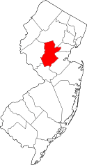 | |
| Townships | ||
| CDPs | ||
| Other unincorporated communities | ||