Rockdale, Kentucky
| Rockdale | |
|---|---|
| Unincorporated community | |
 Rockdale Location within the state of Kentucky  Rockdale Rockdale (the US) | |
| Coordinates: 38°25′8″N 82°41′53″W / 38.41889°N 82.69806°WCoordinates: 38°25′8″N 82°41′53″W / 38.41889°N 82.69806°W | |
| Country | United States |
| State | Kentucky |
| County | Boyd |
| Elevation | 656 ft (200 m) |
| Population (2000) | |
| • Total | 288,649 |
| Time zone | UTC-5 (Eastern (EST)) |
| • Summer (DST) | UTC-4 (EDT) |
| GNIS feature ID | 502159 |
Rockdale is an unincorporated community in Boyd County, Kentucky, United States,[1] located south of Ashland. It is located on Midland Trail (original U.S. Route 60) at its intersection of Kentucky Route 538 and corridor into the city of Ashland. It was mostly a rural area until the 1970s, when a large subdivision began development, with several hundred tract houses.
Rockdale is a part of the Huntington-Ashland Metropolitan Statistical Area (MSA). As of the 2010 census, the MSA had a population of 287,702. New definitions from February 28, 2013 placed the population at 363,000.[2]
Education
References
- ↑ U.S. Geological Survey Geographic Names Information System: Rockdale, Kentucky
- ↑ "Population statistics" (PDF). Archived from the original (PDF) on 2013-03-19.
External links
Municipalities and communities of Boyd County, Kentucky, United States | ||
|---|---|---|
| Cities | 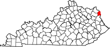 | |
| CDPs | ||
| Unincorporated communities | ||
| Ghost towns | ||
| Footnotes | ‡This populated place also has portions in an adjacent county or counties | |
This article is issued from
Wikipedia.
The text is licensed under Creative Commons - Attribution - Sharealike.
Additional terms may apply for the media files.