Rock Lake (Washington)
| Rock Lake | |
|---|---|
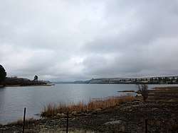 View of Rock Lake from south end | |
| Location | Whitman County, WA |
| Coordinates | 47°10′40″N 117°41′01″W / 47.17778°N 117.68361°W |
| Type | Kolk lake |
| Primary inflows | Rock Creek |
| Primary outflows | Rock Creek |
| Basin countries | United States |
| Max. length | 7 mi (11 km)[1] |
| Max. width | 1 mi (1.6 km)[1] |
| Surface area | 2,190 acres (890 ha)[2] |
| Max. depth | 375 feet (114 m) |
| Surface elevation | 1,728 ft (527 m)[2] |
| Settlements | St. John |
Rock Lake is the deepest and largest of all scabland lakes left behind from the Missoula Floods, and holds that distinction for all of eastern Washington.[2][3] At its deepest, it is more than 360 feet (110 m) deep, although the official measurement is uncertain.[4][5] The lake is over 7 miles (11 km) long and averages 1 mile (1.6 km) in width, and is accessible via a solitary landing area located on the south end.[5] The rest of the shoreline is inaccessible to vehicles, other than a few private properties.
Located approximately 30 miles (48 km) south of Cheney, Rock Lake is in a moderately remote location. Other towns in the area include Sprague, St. John, and Rosalia, although all are a number of miles away.
Rock Lake receives the majority of its water from Rock Creek, which is a tributary of the Palouse River, as well as Negro Creek.
Recreation
The primary recreation activity on Rock Lake is fishing. Popular sport fishing species in the lake include: Crappie, Brown trout, Bluegill, and Rainbow trout.[2]
Running along the eastern shore of the lake is the John Wayne Pioneer Trail. Although this section of the trail is currently not open for public use due to private ownership of the old railroad bed, plans are to continue the trail to Idaho from the Columbia River, and will ultimately include the section along Rock Lake.[6][7]
Dam considerations
A dam was first considered at the mouth of Rock Lake in the lake 1930s, and went so far as to install base columns.[8] The idea of a dam was abandoned at this point because of the difficulty the topography would present. Recently, interest in building a dam at this site has been renewed. The Palouse-Rock Lake Conservation District is interested in having a dam built for the primary purpose of stabilize water supply to right-holders below the dam by creating a consistent flow throughout the year.[8] The current plans for a dam would impound 110,000-120,000 acre feet of water.[8][9]
Reference list
- 1 2 Allen, John Eliot; Burns, Marjorie; Burns, Scott (2009). Cataclysms on the Columbia: The Great Missoula Floods. Ooligan Press. p. 104. ISBN 978-1-932010-31-2. Retrieved 2015-01-19.
- 1 2 3 4 Washington Department of Fish & Wildlife. "Rock Lake". Retrieved 2015-01-16.
- ↑ Bjornstad, Bruce; Kiver, Eugene (2012). On the Trail of the Ice Age Floods: The Northern Reaches. Sandpoint, Idaho: Keokee Co. Publishing, Inc. p. 33. ISBN 978-187962839-7.
- ↑ "Opening day and beyond: Cheney-area trout lakes". Washington Department of Fish & Wildlife. Retrieved 2015-01-19.
- 1 2 "Rock Lake". Spokane Outdoors. Retrieved 2015-01-19.
- ↑ Prager, Mike (2014-02-28). "Palouse section of old rail line to get master plan for trail". Spokesman Review. Retrieved 2015-01-19.
- ↑ Hoch, Don (2014-03-27). "Item E-3: Iron Horse State Park – Master Plan Addendum – Requested Action". Washington State Parks and Recreation Commission. Retrieved 2015-01-19.
- 1 2 3 "Columbia River Water Management Program Grant Application" (PDF). Washington State Department of Ecology. 2007-12-10. Retrieved 2015-01-19.
- ↑ "OCR Funded Projects" (PDF). Washington State Department of Ecology. November 2009. Retrieved 2015-01-19.