Riverway station
RIVERWAY | |||||||||||
|---|---|---|---|---|---|---|---|---|---|---|---|
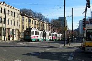 Inbound train and a Dudley-bound route 66 bus at Riverway in 2016 | |||||||||||
| Location |
South Huntington Avenue at Huntington Avenue Boston, Massachusetts | ||||||||||
| Coordinates | 42°19′54.1″N 71°6′43.2″W / 42.331694°N 71.112000°WCoordinates: 42°19′54.1″N 71°6′43.2″W / 42.331694°N 71.112000°W | ||||||||||
| Owned by | Massachusetts Bay Transportation Authority | ||||||||||
| Line(s) | |||||||||||
| Platforms | None - Passengers must wait on sidewalks | ||||||||||
| Tracks | 2 | ||||||||||
| Connections |
| ||||||||||
| Traffic | |||||||||||
| Passengers (2013) | 495 (weekday average boardings)[1] | ||||||||||
| Services | |||||||||||
| |||||||||||
Riverway is a light rail station on the MBTA Green Line "E" Branch, located at the intersection of South Huntington Avenue and Huntington Avenue in Boston, Massachusetts, slightly east of Brookline Village. The station is named for the Riverway parkway which runs on an overpass just to the west.
The station is located on a street running segment of the "E" Branch; trains run in mixed traffic rather than a dedicated median. The station has no platforms; riders wait on the sidewalks (shared with bus stops for the route 39 bus) and cross the street to reach trains. Because of this, the station is not handicapped accessible.
Riverway is also the closest surface transfer between the "D" and "E" branches of the Green Line; Brookline Village station is about 1,500 feet (460 m) to the west.[2] Transferring between the two lines in this manner, however, is outside fare control; passengers doing so must pay an additional fare.
Station layout
| Outbound | ■ "E" Branch | toward Heath (Back of the Hill) |
| Inbound | ■ '"E" Branch | toward Lechmere (Mission Park) |
Bus connections
Riverway is served by two MBTA Bus routes on Huntington Avenue:[2]
- 39: Forest Hills Station - Back Bay Station via Huntington Avenue
- 66 – Harvard Square - Dudley Station via Allston & Brookline Village
Two other routes run on Brookline Avenue slightly to the west:[2]
- 60 Chestnut Hill - Kenmore Station via Brookline Village & Cypress Street
- 65 Brighton Center - Kenmore Station via Washington Street, Brookline Village & Brookline Avenue
References
- ↑ "Ridership and Service Statistics" (PDF) (14th ed.). Massachusetts Bay Transportation Authority. 2014.
- 1 2 3 "Riverway Station Neighborhood Map" (PDF). Massachusetts Bay Transportation Authority. July 2012.
External links
| Wikimedia Commons has media related to Riverway station. |