Risemedet Mountain
| Risemedet Mountain | |
|---|---|
 Risemedet Mountain | |
| Highest point | |
| Elevation | 2,705 metres (8,875 ft) |
| Coordinates | 72°03′S 3°10′E / 72.050°S 3.167°ECoordinates: 72°03′S 3°10′E / 72.050°S 3.167°E |
| Geography | |
 Risemedet Mountain Location in Antarctica | |
| Location | Antarctica |
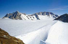
Risemedet Mountain is a large mountain that marks the eastern end of the Gjelsvik Mountains in Queen Maud Land. It was mapped by Norwegian cartographers from surveys and air photos by the Sixth Norwegian Antarctic Expedition (1956–60) and named Risemedet (the giant landmark).[1]
See also
References
- ↑ "Risemedet Mountain". Geographic Names Information System. United States Geological Survey. Retrieved 31 May 2010.
![]()
| General |
| .svg.png) |
|---|---|---|
| Geographic regions | ||
| Waterways | ||
| Famous explorers | ||
This article is issued from
Wikipedia.
The text is licensed under Creative Commons - Attribution - Sharealike.
Additional terms may apply for the media files.