Rise, Aust-Agder
| Rise | |
|---|---|
| Village | |
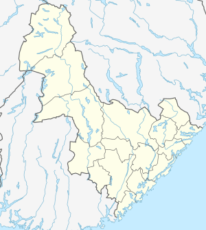
 Rise Location of the village  Rise Rise (Norway) | |
| Coordinates: 58°27′51″N 8°37′39″E / 58.4641°N 08.6276°ECoordinates: 58°27′51″N 8°37′39″E / 58.4641°N 08.6276°E | |
| Country | Norway |
| Region | Southern Norway |
| County | Aust-Agder |
| District | Østre Agder |
| Municipality | Arendal |
| Elevation[1] | 58 m (190 ft) |
| Time zone | UTC+01:00 (CET) |
| • Summer (DST) | UTC+02:00 (CEST) |
| Post Code | 4821 Rykene |
Rise is a village in Arendal municipality in Aust-Agder county, Norway. The village is located on the eastern short of the river Nidelva, along the Arendalsbanen railway line. The Norwegian County Road 408 runs through the village. The village of Libru lies about 3 kilometres (1.9 mi) to the northeast and the village of Løddesøl lies about 2.5 kilometres (1.6 mi) to the south.
References
- ↑ "Rise, Arendal (Aust-Agder)". yr.no. Retrieved 2017-12-03.
This article is issued from
Wikipedia.
The text is licensed under Creative Commons - Attribution - Sharealike.
Additional terms may apply for the media files.