Richland Township, Kingman County, Kansas
| Richland Township | |
|---|---|
| Township | |
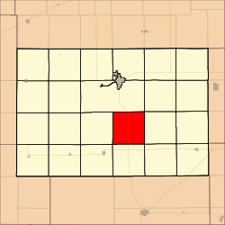 Location in Kingman County | |
| Coordinates: 37°32′30″N 98°07′46″W / 37.54167°N 98.12944°WCoordinates: 37°32′30″N 98°07′46″W / 37.54167°N 98.12944°W | |
| Country | United States |
| State | Kansas |
| County | Kingman |
| Area | |
| • Total | 36.59 sq mi (94.76 km2) |
| • Land | 36.52 sq mi (94.59 km2) |
| • Water | 0.07 sq mi (0.17 km2) 0.18% |
| Elevation | 1,598 ft (487 m) |
| Population (2000) | |
| • Total | 100 |
| • Density | 2.7/sq mi (1.1/km2) |
| GNIS feature ID | 0485459 |
Richland Township is a township in Kingman County, Kansas, USA. As of the 2000 census, its population was 100.[1]
Geography
Richland Township covers an area of 36.59 square miles (94.76 square kilometers); of this, 0.07 square miles (0.17 square kilometers) or 0.18 percent is water.
Unincorporated towns
- Basil
- Cleveland
(This list is based on USGS data and may include former settlements.)
Adjacent townships
- Dale Township (northeast)
- Eagle Township (east)
- Canton Township (southeast)
- Valley Township (south)
- Chikaskia Township (southwest)
- Belmont Township (west)
- Ninnescah Township (north and northwest)
Cemeteries
The township contains one cemetery, Hunt.
Major highways
Airports and landing strips
- Handkins Landing Strip
References
External links
Municipalities and communities of Kingman County, Kansas, United States | ||
|---|---|---|
| Cities | 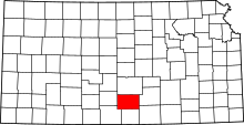 | |
| Unincorporated communities |
| |
| Townships | ||
This article is issued from
Wikipedia.
The text is licensed under Creative Commons - Attribution - Sharealike.
Additional terms may apply for the media files.