Richland Township, Adair County, Iowa
| Richland Township, Adair County | |
|---|---|
| Township | |
 | |
| Coordinates: 41°11′57″N 094°31′30″W / 41.19917°N 94.52500°WCoordinates: 41°11′57″N 094°31′30″W / 41.19917°N 94.52500°W | |
| Country |
|
| State |
|
| County | Adair |
| Area | |
| • Total | 35.67 sq mi (92.38 km2) |
| • Land | 35.64 sq mi (92.31 km2) |
| • Water | 0.03 sq mi (0.07 km2) |
| Elevation[1] | 1,270 ft (387 m) |
| Population (2010) | |
| • Total | 174 |
| • Density | 4.9/sq mi (1.9/km2) |
| Time zone | UTC-6 (CST) |
| • Summer (DST) | UTC-5 (CDT) |
| FIPS code | 19-93570[2] |
| GNIS feature ID | 0468598 |
Richland Township is one of seventeen townships in Adair County, Iowa, USA. At the 2010 census, its population was 174.[3]
History
Richland Township was organized in 1860.[4]
Geography
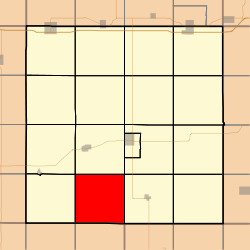
Richland Township covers an area of 35.67 square miles (92.4 km2) and contains no incorporated settlements. According to the USGS, it contains three cemeteries: Penn Avenue, Pleasant Grove and Union.
References
- ↑ "US Board on Geographic Names". United States Geological Survey. 2007-10-25. Retrieved 2008-01-31.
- ↑ "American FactFinder". United States Census Bureau. Archived from the original on September 11, 2013. Retrieved 2008-01-31.
- ↑ "IA - Richland township". United States Census Bureau. Retrieved March 17, 2013.
- ↑ Kilburn, Lucian Moody (1915). History of Adair County, Iowa, and Its People, Volume 1. Pioneer Publishing Company. p. 148.
External links
Municipalities and communities of Adair County, Iowa, United States | ||
|---|---|---|
| Cities | ||
| Townships | ||
| Unincorporated communities | ||
| Footnotes | ‡This populated place also has portions in an adjacent county or counties | |
This article is issued from
Wikipedia.
The text is licensed under Creative Commons - Attribution - Sharealike.
Additional terms may apply for the media files.