Riberalta
| Riberalta | |
|---|---|
| Town and municipality | |
 Riberalta, Bolivia | |
 Riberalta Location of Riberalta town in Bolivia | |
| Coordinates: 10°59′S 66°6′W / 10.983°S 66.100°W | |
| Country |
|
| Department |
|
| Province | Vaca Díez Province |
| Settled | 1897 |
| Area | |
| • Total | 20.1 km2 (7.8 sq mi) |
| Elevation | 144 m (472 ft) |
| Population (2018) | |
| • Total | 99,070 |
| • Density | 4,900/km2 (13,000/sq mi) |
| Area code(s) | +591 2 |
| Website | Official website |
Riberalta is a town in the Beni Department in northern Bolivia, situated where the Madre de Dios River joins the Beni River. Riberalta is on the south (south east) bank of the Beni River.
As the capital of the province of Vaca Diez, the city has maintained its charm even after the Brazilian nut trade sparked recent development. City life in Riberalta Municipality[1] is punctuated by nature thanks to its location on the banks of the Beni and Madre de Dios rivers and its proximity to the Amazon rainforest. The city is also called the Bolivian capital of the Amazon.
The town population is 99,070 in 2018.
History
Riberalta’s name comes from the union of two words in Spanish: “ribera alta” (“high bank” in English.) The city was founded on February 3, 1894 with approximately 2,500 inhabitants established in a red canyon in Northern Bolivia.
It is also known as the city of four names: Barranca Colorada (Red Canyon), La Cruz (The Cross), Ribera-Alta (High Bank), and Riberalta.[2] Starting in the middle of the 19th century, solo explorers and navigators of the Bolivian Northwest penetrated the solitary jungle; They founded barracks more than thirty meters high, erected and blessed by the convergence of two colossal rivers, which turned the municipality into the economic center of the north of the country.
On October 8, 1880, Don Edwin Heath named the city Barranca Colorada. A few years later Frederico Bodo Claussen, manager of House Braillard de Reyes, was informed of the barracks and sent a German subject with resources to install a commercial factory there.[3] Afterwards, it received the name La Cruz on May 3, 1884 when Don Maximo Henicke surveyed a small home built two years earlier in 1882 by Placido Mendez. A little over a year later, on July 7 of 1885, Bodo Claussen baptized the city under the name Ribera-Alta, which later was combined into Riberalta. Nine years later, on February 3 of 1894, Riberalta was founded with an official act under the name Villa Riberalta, after having already existed for twelve years.[4] It was founded by a National Delegate of the Colonies, Lysimachus Gutiérrez, who did so under the orders of President Mariano Baptista and in honor of the birth of the Mcal. Antonio Jose de Sucre.
Climate

This area typically has a pronounced dry season. According to the Köppen Climate Classification system, Riberalta has a tropical savanna climate, abbreviated "Aw" on climate maps.[5]
| Climate data for Riberalta, Bolivia | |||||||||||||
|---|---|---|---|---|---|---|---|---|---|---|---|---|---|
| Month | Jan | Feb | Mar | Apr | May | Jun | Jul | Aug | Sep | Oct | Nov | Dec | Year |
| Record high °C (°F) | 35.0 (95) |
35.0 (95) |
36.0 (96.8) |
34.6 (94.3) |
35.8 (96.4) |
33.3 (91.9) |
34.2 (93.6) |
36.4 (97.5) |
38.3 (100.9) |
36.5 (97.7) |
36.0 (96.8) |
36.8 (98.2) |
38.3 (100.9) |
| Average high °C (°F) | 30.2 (86.4) |
30.8 (87.4) |
31.5 (88.7) |
30.7 (87.3) |
29.4 (84.9) |
30.1 (86.2) |
30.5 (86.9) |
32.1 (89.8) |
33.3 (91.9) |
32.2 (90) |
31.3 (88.3) |
31.3 (88.3) |
31.1 (88) |
| Daily mean °C (°F) | 27.1 (80.8) |
27.0 (80.6) |
27.1 (80.8) |
26.8 (80.2) |
26.4 (79.5) |
25.6 (78.1) |
25.7 (78.3) |
27.3 (81.1) |
28.2 (82.8) |
28.1 (82.6) |
27.7 (81.9) |
27.3 (81.1) |
27.0 (80.6) |
| Average low °C (°F) | 22.3 (72.1) |
22.4 (72.3) |
21.7 (71.1) |
21.4 (70.5) |
18.7 (65.7) |
16.8 (62.2) |
17.5 (63.5) |
18.4 (65.1) |
20.3 (68.5) |
21.5 (70.7) |
21.6 (70.9) |
21.8 (71.2) |
20.4 (68.7) |
| Record low °C (°F) | 20.6 (69.1) |
20.0 (68) |
17.2 (63) |
15.0 (59) |
10.0 (50) |
9.9 (49.8) |
8.9 (48) |
10.0 (50) |
13.8 (56.8) |
16.1 (61) |
16.0 (60.8) |
19.0 (66.2) |
8.9 (48) |
| Average precipitation mm (inches) | 228 (8.98) |
242 (9.53) |
244 (9.61) |
170 (6.69) |
80 (3.15) |
31 (1.22) |
15 (0.59) |
20 (0.79) |
69 (2.72) |
121 (4.76) |
161 (6.34) |
230 (9.06) |
1,588 (62.52) |
| Average precipitation days (≥ 0.1 mm) | 17 | 17 | 18 | 13 | 7 | 3 | 2 | 2 | 5 | 10 | 12 | 16 | 122 |
| Average relative humidity (%) | 79 | 80 | 80 | 81 | 78 | 76 | 70 | 68 | 68 | 72 | 76 | 80 | 76 |
| Source: Deutscher Wetterdienst[6] | |||||||||||||
Do
The city and its surroundings have many pleasant places to spend an hour, a half day, a day or a weekend.
- In Riberalta: You can walk along the river or in the main square while enjoying an açaí juice or eating in one of the many restaurants. You can also wander the streets of the city on foot or by motorbike in search on the many usual statues found in Riberalta.. You can get a good sense of the local lifestyle by going to the market to enjoy a dish in the "comedors" and then get lost between the many vendors selling typical fruits of the region like copuaçu, açaí and lima.
- Around Riberalta:
The main attraction of Riberalta is undoubtedly its proximity to the Amazon rainforest which can be discovered in many places around Riberalta.
Aquicuana reserve: This natural reserve of more than 20 000 hectares is the ideal place to observe Amazonian fauna and flora. The name of the reserve means ¨the place of gigantic trees¨ in the native language Tacana. The reserve is composed of a lake, Lake San José, two local communities (Warnes and San José) and a medicinal retreat center, Pisatahua. Residents of the communities are available to act as guides for a day since they know the most about the reserve and its flora and fauna.
Pisatahua: Pisatahua is a medicinal retreat center located in the heart of the Amazon in the Aquicuana Reserve. The center offers stays of 9 days or more to perform Ayahuasca ceremonies. This idyllic environment offers an incomparable setting to immerse yourself in the beauty of the Amazon jungle while working with traditional medicinal plants.
Tumichucua lake: This lake is a protected area. It is possible to go around the island in the center by boat or to explore in search of its fauna. The flora is more easily enjoyed with a hike on the shores of the lake. Swimming is allowed.
Esmeralda park: Esmeralda is a natural pool formed from a lake. Here you can bathe safely or take a boat ride to birdwatch in the other part of the lake.
Volunteering
- Sustainable Bolivia is an organization that coordinates volunteers and grassroots organizations in Riberalta, and also offers Spanish and indigenous languages classes. You can live in Sustainable Bolivia´s volunteer house, stay with a family, or live in a hostel while volunteering or taking classes. It´s a great way to learn about the city. Grants to organizations are administered by the volunteers themselves, so they know how the money is being used.
See also
References
- ↑ Municipalities of Bolivia at www.editorialox.com
- ↑ Lougheed, Vivien (2004). Bolivia Adventure Guide. Edison, NJ: Hunter. p. 514. ISBN 978-1588433657.
- ↑ Fifer, J. Valerie (1970). "The Empire Builders: A History of the Bolivian Rubber Boom and the Rise of the House of Suarez". Cambridge University Press. 2 (2): 113. JSTOR 156583.
- ↑ Vallve, Frederic (January 22, 2010). "The Impact of the Rubber Boom on the Indigenous Peoples of the Bolivian Lowlands" (PDF). Georgetwon University: 112. Retrieved March 5, 2017.
- ↑ Climate Summary for Riberalta
- ↑ "Klimatafel von Riberalta, Prov. Pando / Bolivien" (PDF). Baseline climate means (1961-1990) from stations all over the world (in German). Deutscher Wetterdienst. Retrieved 27 January 2016.
External links
Coordinates: 11°0′46″S 66°3′26″W / 11.01278°S 66.05722°W
Capital: La Santísima Trinidad | ||
| Provinces | 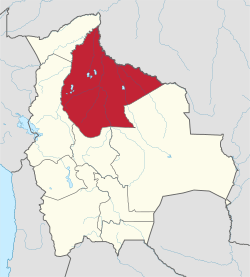 | |
| Municipalities and seats |
| |