Rhodelia, Kentucky
| Rhodelia, Kentucky | |
|---|---|
| Unincorporated community | |
 Rhodelia Location within the state of Kentucky  Rhodelia Rhodelia (the US) | |
| Coordinates: 38°00′25″N 86°25′14″W / 38.00694°N 86.42056°WCoordinates: 38°00′25″N 86°25′14″W / 38.00694°N 86.42056°W | |
| Country | United States |
| State | Kentucky |
| County | Meade |
| Elevation | 646 ft (197 m) |
| Time zone | UTC-5 (Eastern (EST)) |
| • Summer (DST) | UTC-4 (EST) |
| GNIS feature ID | 508929[1] |
Rhodelia is a rural unincorporated community in Meade County, Kentucky, United States. It is a small community that lies a few miles west of Brandenburg on KY 144 near its intersection with Rhodes Road and south of KY 144's intersection with KY 259.
History
A post office called Rhodelia was established in 1879.[2] The community was named for Elias Rhodes, a pioneer settler.[3]
Near Rhodelia is St. Theresa Roman Catholic Church, listed on the National Register of Historic Places.
References
- ↑ U.S. Geological Survey Geographic Names Information System: Rhodelia, Kentucky
- ↑ "Meade County". Jim Forte Postal History. Retrieved 25 December 2015.
- ↑ Rennick, Robert M. Kentucky Place Names. University Press of Kentucky. p. 250. ISBN 0-8131-2631-2.
Municipalities and communities of Meade County, Kentucky, United States | ||
|---|---|---|
| Cities | 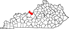 | |
| CDPs | ||
| Unincorporated communities | ||
| Footnotes | ‡This populated place also has portions in an adjacent county or counties | |
This article is issued from
Wikipedia.
The text is licensed under Creative Commons - Attribution - Sharealike.
Additional terms may apply for the media files.