Reynolds Station, Kentucky
| Reynolds Station, Kentucky | |
|---|---|
| Unincorporated community | |
 Reynolds Station  Reynolds Station | |
| Coordinates: 37°39′17″N 86°48′15″W / 37.65472°N 86.80417°WCoordinates: 37°39′17″N 86°48′15″W / 37.65472°N 86.80417°W | |
| Country | United States |
| State | Kentucky |
| County | Ohio |
| Elevation | 453 ft (138 m) |
| Time zone | UTC-6 (Central (CST)) |
| • Summer (DST) | UTC-5 (CDT) |
| ZIP code | 42368 |
| Area code(s) | 270 & 364 |
| GNIS feature ID | 501749[1] |
Reynolds Station is an unincorporated community in Ohio County, Kentucky, United States.[1] The community is located on Kentucky Route 54 5 miles (8.0 km) west-northwest of Fordsville.[2] Reynolds Station has a post office with ZIP code 42368, which opened on April 22, 1890.[3][4]
References
- 1 2 "Reynolds Station". Geographic Names Information System. United States Geological Survey.
- ↑ State Primary Road System: Ohio County (PDF) (Map). Kentucky Transportation Cabinet. June 2016. Retrieved April 17, 2017.
- ↑ United States Postal Service. "USPS - Look Up a ZIP Code". Retrieved April 17, 2017.
- ↑ "Postmaster Finder - Post Offices by ZIP Code". United States Postal Service. Retrieved April 17, 2017.
Municipalities and communities of Ohio County, Kentucky, United States | ||
|---|---|---|
| Cities | 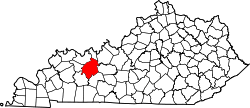 | |
| CDP | ||
| Other unincorporated communities | ||
This article is issued from
Wikipedia.
The text is licensed under Creative Commons - Attribution - Sharealike.
Additional terms may apply for the media files.