Remedios T. Romualdez, Agusan del Norte
| Remedios T. Romualdez | ||
|---|---|---|
| Municipality | ||
| Municipality of Remedios T. Romualdez | ||
| ||
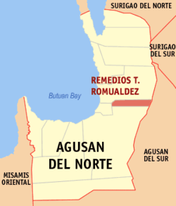 Map of Agusan del Norte with Remedios T. Romualdez highlighted | ||
.svg.png) Remedios T. Romualdez Location within the Philippines | ||
| Coordinates: 9°03′N 125°35′E / 9.05°N 125.59°ECoordinates: 9°03′N 125°35′E / 9.05°N 125.59°E | ||
| Country |
| |
| Region | Caraga (Region XIII) | |
| Province | Agusan del Norte | |
| District | 2nd District | |
| Founded | September 12, 1982 | |
| Named for | Remedios Trinidad Romualdez | |
| Barangays | 8 (see Barangays) | |
| Government [1] | ||
| • Type | Sangguniang Bayan | |
| • Mayor | Ernie M. Ceniza | |
| • Electorate | 11,234 voters (2016) | |
| Area [2] | ||
| • Total | 79.15 km2 (30.56 sq mi) | |
| Population (2015 census)[3] | ||
| • Total | 16,058 | |
| • Density | 200/km2 (530/sq mi) | |
| Time zone | UTC+8 (PST) | |
| ZIP code | 8611 | |
| PSGC | 160212000 | |
| IDD : area code | +63 (0)85 | |
| Climate type | Tropical rainforest climate | |
| Income class | 5th municipal income class | |
| Revenue (₱) | 61,273,156.06 (2016) | |
| Native languages |
Agusan language Butuanon Cebuano Higaonon Tagalog | |
| Website |
www | |

Remedios T. Romualdez, officially the Municipality of Remedios T. Romualdez, (Cebuano: Lungsod sa Remedios T. Romualdez; Tagalog: Bayan ng Remedios T. Romualdez), is a 5th class municipality in the province of Agusan del Norte, Philippines. According to the 2015 census, it has a population of 16,058 people.[3]
Remedios T. Romualdez was created into a municipality on September 12, 1982, when the barangays of Tagbogabong, San Antonio, Basilisa, and Panaytayon, all of the then-municipality of Cabadbaran, were constituted into the newly created town, through Batas Pambansa Blg. 236.[4] It was named after Remedios Trinidad Romualdez, mother of then First Lady and Congresswoman Imelda Romualdez Marcos. The town is one of the leading rice producers of Agusan del Norte province.
It is situated along the Maharlika Highway. It is bounded to the north by Cabadbaran, south by Butuan City, east by Sibagat, and west by Magallanes.
Geography
Remedios T. Romualdez is located at 9°03′N 125°35′E / 9.05°N 125.59°E.
According to the Philippine Statistics Authority, the municipality has a land area of 79.15 square kilometres (30.56 sq mi) [2] constituting 2.90% of the 2,730.24-square-kilometre- (1,054.15 sq mi) total area of Agusan del Norte.
Barangays
Remedios T. Romualdez is politically subdivided into 8 barangays.[5]
| PSGC | Barangay | Population | ±% p.a. | |||
|---|---|---|---|---|---|---|
| 2015[3] | 2010[6] | |||||
| 160212002 | Balangbalang | 15.5% | 2,482 | 2,362 | 0.95% | |
| 160212003 | Basilisa | 13.6% | 2,181 | 2,092 | 0.80% | |
| 160212004 | Humilog | 11.0% | 1,768 | 1,675 | 1.03% | |
| 160212005 | Panaytayon | 6.8% | 1,084 | 1,077 | 0.12% | |
| 160212001 | Poblacion I (Agay) | 16.3% | 2,611 | 2,581 | 0.22% | |
| 160212008 | Poblacion II | 11.0% | 1,764 | 2,027 | −2.61% | |
| 160212006 | San Antonio | 13.2% | 2,122 | 1,958 | 1.54% | |
| 160212007 | Tagbongabong | 12.7% | 2,046 | 1,963 | 0.79% | |
| Total | 16,058 | 15,735 | 0.39% | |||
Demographics
| Population census of Remedios T. Romualdez | ||
|---|---|---|
| Year | Pop. | ±% p.a. |
| 1990 | 10,490 | — |
| 1995 | 12,621 | +3.53% |
| 2000 | 13,359 | +1.23% |
| 2007 | 14,976 | +1.59% |
| 2010 | 15,735 | +1.82% |
| 2015 | 16,058 | +0.39% |
| Source: Philippine Statistics Authority[3][6][7][8] | ||
In the 2015 census, Remedios T. Romualdez had a population of 16,058.[3] The population density was 200 inhabitants per square kilometre (520/sq mi).
References
- ↑ "Municipality". Quezon City, Philippines: Department of the Interior and Local Government. Retrieved 31 May 2013.
- 1 2 "Province: Agusan del Norte". PSGC Interactive. Quezon City, Philippines: Philippine Statistics Authority. Retrieved 12 November 2016.
- 1 2 3 4 5 Census of Population (2015). "Caraga". Total Population by Province, City, Municipality and Barangay. PSA. Retrieved 20 June 2016.
- ↑ "Batas Pambansa Blg. 236 - An Act Creating the Municipality of Remedios T. Romualdez in the Province of Agusan Del Norte". Chan Robles Virtual Law Library. 12 September 1982. Archived from the original on 27 October 2013. Retrieved 17 October 2016.
- ↑ "Municipal: Remedios T. Romualdez, Agusan del Norte". PSGC Interactive. Quezon City, Philippines: Philippine Statistics Authority. Retrieved 8 January 2016.
- 1 2 Census of Population and Housing (2010). "Caraga". Total Population by Province, City, Municipality and Barangay. NSO. Retrieved 29 June 2016.
- ↑ Censuses of Population (1903–2007). "Caraga". Table 1. Population Enumerated in Various Censuses by Province/Highly Urbanized City: 1903 to 2007. NSO.
- ↑ "Province of Agusan del Norte". Municipality Population Data. Local Water Utilities Administration Research Division. Retrieved 17 December 2016.
External links
| Wikimedia Commons has media related to Remedios T. Romualdez, Agusan del Norte. |
Places adjacent to Remedios T. Romualdez, Agusan del Norte | ||||||||||
|---|---|---|---|---|---|---|---|---|---|---|
| ||||||||||
Cabadbaran (capital) | |
| Municipalities | |
| Component city | |
| Highly urbanized city |
|