Red Rock Coulee
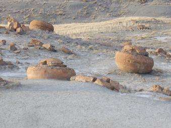
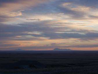
Red Rock Coulee is located in south-eastern Alberta, Canada. It is 54 km south southwest of the city of Medicine Hat or 26 km south of the hamlet of Seven Persons) on Highway 887. The main feature of this natural landscape is the huge red boulders; some measuring 2.5 m across. They are scattered over a relatively small distance and can be viewed without walking far at all. From the viewpoint off Highway 887 you can view the red rocks and see the Sweetgrass Hills of Montana on the horizon.
Geographical Features
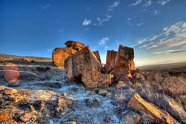
Many features make Red Rock Coulee a special site to visit. Bedrock is close to the surface in this area, covered by only a thin layer of soil. Water erosion has carved the landscape over time and a badlands topography has formed in places. The bands of colour visible in the exposed bedrock are made of dark gray shales, greenish and gray sandstones, bentonitic clays and thin bands of ironstone.
The most striking features of this landscape are the round reddish boulders. These are sandstone concretions and at up to 2.5 m in diameter, they are among the largest in the world. The boulders were formed in prehistoric seas as layers of sand, calcite and iron oxide collected around a nucleus formed by shells, leaves or bones. The concretions grew larger as the circulating waters deposited more layers. The reddish colour comes from iron oxide. Look carefully at the concretions - you may be able to see their "growth rings" (layers of sediment deposition) and fossilized shells, leaves or bones. [1]
See also

Coordinates: 49°40′40″N 111°01′46″W / 49.67778°N 111.02944°W