Rantoul, Illinois
| Rantoul | |
|---|---|
| Village | |
| The Corporate Village of Rantoul | |
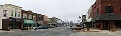 Downtown Rantoul | |
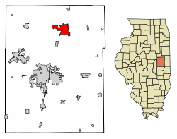 Location of Rantoul in Champaign County, Illinois. | |
 Rantoul Location within Champaign County  Rantoul Rantoul (Illinois) | |
| Coordinates: 40°18′17″N 88°09′07″W / 40.30472°N 88.15194°WCoordinates: 40°18′17″N 88°09′07″W / 40.30472°N 88.15194°W | |
| Country | United States |
| State | Illinois |
| County | Champaign |
| Townships | Rantoul, Ludlow |
| Founded | March 4, 1854 |
| Government | |
| • Village President | Charles Smith |
| Area[1] | |
| • Total | 8.62 sq mi (22.32 km2) |
| • Land | 8.51 sq mi (22.04 km2) |
| • Water | 0.11 sq mi (0.28 km2) |
| Elevation[2] | 745 ft (227 m) |
| Population (2010) | |
| • Total | 12,941 |
| • Estimate (2016)[3] | 12,815 |
| • Density | 1,505.70/sq mi (581.34/km2) |
| Time zone | UTC-6 (CST) |
| • Summer (DST) | UTC-5 (CDT) |
| Postal code | 61866 |
| Area code(s) | 217 |
| FIPS code | 17-62783 |
| Website |
www |
Rantoul is a village in Champaign County, Illinois, United States. The population was 12,941 at the 2010 census. The current mayor is Chuck Smith, who was elected in 2013. The community was named after Robert Rantoul, Jr., a U.S. representative from Massachusetts, and a director of the Illinois Central Railroad.[4][5]
History
Rantoul was laid out in 1854 for the Illinois Central Railroad by John Penfield. A post office was established in 1856 as Rantoul Station; the name was changed to Rantoul in May 1862.[4]
In 1917, Rantoul was chosen by the United States Army to be the site of Chanute Field,[6] due to its proximity to the Illinois Central railroad and the War Department’s ground school at the University of Illinois. In the 1930s, Chanute Field grew, dominating the local economy as thousands of airmen were stationed there to train recruits. Renamed Chanute Air Force Base after World War II, it was closed in 1993, but was partly reoccupied by the Octave Chanute Aerospace Museum , which was permanently closed on December 30, 2015, and the Rantoul National Aviation Center. Rantoul's economy has taken a sharp decline due to the base's closing, from which it has never recovered. The book Eye of the Storm: Chanute Closes by Katy B. Podagrosi tells the story of this period.
Geography
Rantoul is located at 40°18′17″N 88°9′7″W / 40.30472°N 88.15194°W (40.304600, -88.152070).[7]
According to the 2010 census, Rantoul has a total area of 8.259 square miles (21.39 km2), of which 8.15 square miles (21.11 km2) (or 98.68%) is land and 0.109 square miles (0.28 km2) (or 1.32%) is water.[8]
Demographics
| Historical population | |||
|---|---|---|---|
| Census | Pop. | %± | |
| 1880 | 850 | — | |
| 1890 | 1,074 | 26.4% | |
| 1900 | 1,207 | 12.4% | |
| 1910 | 1,384 | 14.7% | |
| 1920 | 1,551 | 12.1% | |
| 1930 | 1,555 | 0.3% | |
| 1940 | 2,367 | 52.2% | |
| 1950 | 6,387 | 169.8% | |
| 1960 | 22,116 | 246.3% | |
| 1970 | 25,562 | 15.6% | |
| 1980 | 20,161 | −21.1% | |
| 1990 | 17,212 | −14.6% | |
| 2000 | 12,857 | −25.3% | |
| 2010 | 12,941 | 0.7% | |
| Est. 2016 | 12,815 | [3] | −1.0% |
| U.S. Decennial Census[9] | |||
As of the census[10] of 2000, there were 12,857 people, 5,330 households, and 3,367 families residing in the village. The population density was 1,776.5 people per square mile (685.7/km²). There were 6,161 housing units at an average density of 851.3 per square mile (328.6/km²). The racial makeup of the village was 76.69% White, 16.88% African American, 0.47% Native American, 1.75% Asian, 0.05% Pacific Islander, 0.89% from other races, and 3.27% from two or more races. Hispanic or Latino of any race were 2.69% of the population.
There were 5,330 households out of which 33.7% had children under the age of 18 living with them, 43.9% were married couples living together, 15.0% had a female householder with no husband present, and 36.8% were non-families. 30.8% of all households were made up of individuals and 10.2% had someone living alone who was 65 years of age or older. The average household size was 2.41 and the average family size was 3.02.
In the village, the population was spread out with 28.6% under the age of 18, 9.5% from 18 to 24, 32.2% from 25 to 44, 18.2% from 45 to 64, and 11.4% who were 65 years of age or older. The median age was 32 years. For every 100 females, there were 91.0 males. For every 100 females age 18 and over, there were 86.7 males.
The median income for a household in the village was $36,904, and the median income for a family was $43,543. Males had a median income of $32,440 versus $22,382 for females. The per capita income for the village was $17,948. About 8.5% of families and 10.7% of the population were below the poverty line, including 14.7% of those under age 18 and 4.6% of those age 65 or over.
Rail transportation
Amtrak, the national passenger rail system, provides service to Rantoul. Amtrak Train 391, the southbound Saluki, is scheduled to depart Rantoul at 11:10am daily with service to Champaign-Urbana, Mattoon, Effingham, Centralia, Du Quoin, and Carbondale. Amtrak Train 393, the southbound Illini, is scheduled to depart Rantoul at 6:00pm daily serving the same points as the southbound Saluki. Amtrak Train 390, the northbound Saluki, is scheduled to depart Rantoul at 10:27am daily with service to Gilman, Kankakee, Homewood, and Chicago. Amtrak Train 887, the northbound Illini, is scheduled to depart Rantoul at 7:02pm daily serving the same points as the northbound Saluki.[11]
Air transportation
Notable people
- Don Branson, auto racer
- Sean Bubin, offensive lineman of the Detroit Lions and New England Patriots [12])
- Darren W. McDew, U.S. Air Force general
- Greg McMahon, special teams coordinator for the New Orleans Saints; Rantoul native[13]
- C. Adrian Pillars, sculptor
- Jheri Redding, hairdresser, chemist, hair care products entrepreneur and businessman; best known for creating the Jheri curl.
- Alan Ritchson, actor most known for Blue Mountain State
- Blake Schilb, professional basketball player, playing for Red Star Belgrade
- Craig Vetter, innovative designer of motorcycles and motorcycle accessories, inducted into the AMA Motorcycle Hall of Fame in 1999[14]
Activities
- Illinois Skydiving Center, a major center of that sport, located in nearby Flatville.
- Octave Chanute Aerospace Museum, detailing the history of Flight, Military Aviation, and Chanute Air Force Base, located on the old Base. Closed in 2015.
- Korean War Veterans Museum, a Museum currently under construction detailing the history of the Korean War, located on the old Base.
- Rantoul Theater Group, offering drama, comedy, and musical live entertainment
Schools
- Rantoul Township High School, the only high school in Rantoul, Illinois and stands as its own district. RTHS serves students from Rantoul, Gifford, Thomasboro, Ludlow and the surrounding rural area. More information is provided through the provided link. The University of Illinois football scrimmage game is usually held at the high school field in August.
- St. Malachy Grade School a Catholic Grade School in Rantoul, IL.
- Rantoul City Schools District 137 is a K-8 District with Grade Level Centers, made up of 5 schools: Eastlawn (K-2), Pleasant Acres (K-2), Broadmeadow (3-5), Northview (3-5), and Eater (6-8).
- Lincoln's ChalleNGe Academy In 1993, the Center for Strategic and International Studies published a study entitled, Forging a Military Youth Corps. That same year, Congress, acting upon the studies recommendations, provided funding in the 1993 Defense Authorization Act for the National Guard Bureau to conduct a pilot youth intervention program. The purpose of this pilot program was to determine if life coping skills and employability of a high school dropout could be significantly improved through participation in a life skills program using a military model.
- University of Illinois Advanced Transportation and Research Engineering Laboratory (ATREL) ATREL is a 47-acre laboratory site where pavement, railroad, and transportation systems are researched, studied, and tested.
References
- ↑ "2016 U.S. Gazetteer Files". United States Census Bureau. Retrieved Jun 30, 2017.
- ↑ "USGS detail on Newtown". Retrieved October 21, 2007.
- 1 2 "Population and Housing Unit Estimates". Retrieved June 9, 2017.
- 1 2 Callary, Edward (2009). Place Names of Illinois. Urbana and Chicago: University of Illinois Press. p. 290. ISBN 978-0-252-03356-8.
- ↑ Illinois Central Magazine. Illinois Central Railroad Company. 1922. p. 46.
- ↑ "[pamphlet]" (PDF). Chaunte Air Museum. Octave Chanute Aerospace Heritage Foundation. Retrieved May 19, 2012.
- ↑ "US Gazetteer files: 2010, 2000, and 1990". United States Census Bureau. February 12, 2011. Retrieved April 23, 2011.
- ↑ "G001 - Geographic Identifiers - 2010 Census Summary File 1". United States Census Bureau. Retrieved December 25, 2015.
- ↑ "Census of Population and Housing". Census.gov. Retrieved June 4, 2015.
- ↑ "American FactFinder". United States Census Bureau. Retrieved January 31, 2008.
- ↑ http://www.amtrak.com/timetable/oct06/P58.pdf
- ↑ Boston: The Boston Globe [Bubin Retires, April 20, 2007 (accessed 8 July 2007)]
- ↑ Daniels, Matt Daniels (July 18, 2012). "The Column: No interview with McMahon". Rantoul Press.
- ↑ "Craig Vetter at the AMA Hall of Fame". motorcyclemuseum.org. Retrieved February 4, 2017.
External links
| Wikimedia Commons has media related to Rantoul, Illinois. |
- Early History of Rantoul, Il (1871)
- Village of Rantoul Official Site
- Rantoul Area Chamber of Commerce
- History of Rantoul Township
Municipalities and communities of Champaign County, Illinois, United States | ||
|---|---|---|
| Cities | ||
| Villages | ||
| Townships | ||
| CDPs | ||
| Other unincorporated communities | ||
| Footnotes | ‡This populated place also has portions in an adjacent county or counties | |