Ransom, Kansas
| Ransom, Kansas | |
|---|---|
| City | |
 Location within Ness County and Kansas | |
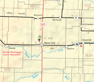 KDOT map of Ness County (legend) | |
| Coordinates: 38°38′7″N 99°55′57″W / 38.63528°N 99.93250°WCoordinates: 38°38′7″N 99°55′57″W / 38.63528°N 99.93250°W | |
| Country | United States |
| State | Kansas |
| County | Ness |
| Area[1] | |
| • Total | 0.32 sq mi (0.83 km2) |
| • Land | 0.32 sq mi (0.83 km2) |
| • Water | 0 sq mi (0 km2) |
| Elevation | 2,513 ft (766 m) |
| Population (2010)[2] | |
| • Total | 294 |
| • Estimate (2016)[3] | 274 |
| • Density | 920/sq mi (350/km2) |
| Time zone | UTC-6 (Central (CST)) |
| • Summer (DST) | UTC-5 (CDT) |
| ZIP code | 67572 |
| Area code | 785 |
| FIPS code | 20-58500 [4] |
| GNIS feature ID | 0475372 [5] |
| Website | City website |
Ransom is a city in Ness County, Kansas, United States. As of the 2010 census, the city population was 294.[6]
History
The namesake of Ransom is Thomas E. G. Ransom.[7]
The first post office in Ransom was established in 1887, but it was called Ogdensburgh until 1888.[8]
Ransom was incorporated as a city in 1905.[9]
Geography
Ransom is located at 38°38′7″N 99°55′57″W / 38.63528°N 99.93250°W (38.635344, -99.932434).[10] According to the United States Census Bureau, the city has a total area of 0.32 square miles (0.83 km2), all land.[1]
Climate
The climate in this area is characterized by hot, humid summers and generally mild to cool winters. According to the Köppen Climate Classification system, Ransom has a humid subtropical climate, abbreviated "Cfa" on climate maps.[11]
Demographics
| Historical population | |||
|---|---|---|---|
| Census | Pop. | %± | |
| 1910 | 204 | — | |
| 1920 | 285 | 39.7% | |
| 1930 | 431 | 51.2% | |
| 1940 | 403 | −6.5% | |
| 1950 | 405 | 0.5% | |
| 1960 | 387 | −4.4% | |
| 1970 | 416 | 7.5% | |
| 1980 | 448 | 7.7% | |
| 1990 | 386 | −13.8% | |
| 2000 | 338 | −12.4% | |
| 2010 | 294 | −13.0% | |
| Est. 2016 | 274 | [3] | −6.8% |
| U.S. Decennial Census | |||
2010 census
As of the census[2] of 2010, there were 294 people, 129 households, and 80 families residing in the city. The population density was 918.8 inhabitants per square mile (354.8/km2). There were 178 housing units at an average density of 556.3 per square mile (214.8/km2). The racial makeup of the city was 99.3% White and 0.7% from two or more races. Hispanic or Latino of any race were 0.7% of the population.
There were 129 households of which 24.8% had children under the age of 18 living with them, 51.2% were married couples living together, 7.0% had a female householder with no husband present, 3.9% had a male householder with no wife present, and 38.0% were non-families. 36.4% of all households were made up of individuals and 22.5% had someone living alone who was 65 years of age or older. The average household size was 2.08 and the average family size was 2.68.
The median age in the city was 52.7 years. 19.4% of residents were under the age of 18; 3% were between the ages of 18 and 24; 16.1% were from 25 to 44; 25.8% were from 45 to 64; and 35.7% were 65 years of age or older. The gender makeup of the city was 46.9% male and 53.1% female.
2000 census
As of the census[4] of 2000, there were 338 people, 141 households, and 83 families residing in the city. The population density was 1,036.3 people per square mile (395.5/km²). There were 179 housing units at an average density of 548.8 per square mile (209.4/km²). The racial makeup of the city was 99.41% White, 0.30% from other races, and 0.30% from two or more races. 0.59% of the population were Hispanic or Latino of any race.
There were 141 households out of which 26.2% had children under the age of 18 living with them, 49.6% were married couples living together, 7.8% had a female householder with no husband present, and 41.1% were non-families. 40.4% of all households were made up of individuals and 23.4% had someone living alone who was 65 years of age or older. The average household size was 2.17 and the average family size was 2.88.
In the city, the population was spread out with 23.7% under the age of 18, 2.7% from 18 to 24, 20.1% from 25 to 44, 21.9% from 45 to 64, and 31.7% who were 65 years of age or older. The median age was 47 years. For every 100 females, there were 82.7 males. For every 100 females age 18 and over, there were 76.7 males.
The median income for a household in the city was $31,771, and the median income for a family was $43,333. Males had a median income of $28,542 versus $18,906 for females. The per capita income for the city was $18,123. 5.2% of the population and 2.8% of families were below the poverty line. None of those under the age of 18 and 13.3% of those 65 and older were living below the poverty line.
Education
School
Western Plains USD 106 serves Arnold, Bazine, Brownell, Ransom and Utica.[12] The Western Plains High School mascot is Bobcats.
Ransom High School was closed through school unification.[13] The Ransom Longhorns won the Kansas State High School boys class 1A Track & Field championship in 1972 and 1999.[14]
Library
Ransom is served by the Ransom Public Library.[15]
Notable people
- Nolan Cromwell, NFL coach and former player. Ransom High class of 1973
- Bertha Horchem, pilot who in 1923 set the woman's altitude record in an aircraft at 16,300 feet[16]
- Ruth Riley, professional basketball player
References
- 1 2 "US Gazetteer files 2010". United States Census Bureau. Archived from the original on 2012-07-14. Retrieved 2012-07-06.
- 1 2 "American FactFinder". United States Census Bureau. Retrieved 2012-07-06.
- 1 2 "Population and Housing Unit Estimates". Retrieved June 9, 2017.
- 1 2 "American FactFinder". United States Census Bureau. Retrieved 2008-01-31.
- ↑ "US Board on Geographic Names". United States Geological Survey. 2007-10-25. Retrieved 2008-01-31.
- ↑ "2010 City Population and Housing Occupancy Status". U.S. Census Bureau. Retrieved September 13, 2011.
- ↑ "Profile for Ransom, Kansas". ePodunk. Retrieved 19 June 2014.
- ↑ "Kansas Post Offices, 1828-1961, page 2". Kansas Historical Society. Retrieved 19 June 2014.
- ↑ Blackmar, Frank Wilson (1912). Kansas: A Cyclopedia of State History, Volume 2. Standard Publishing Company. p. 549.
- ↑ "US Gazetteer files: 2010, 2000, and 1990". United States Census Bureau. 2011-02-12. Retrieved 2011-04-23.
- ↑ Climate Summary for Ransom, Kansas
- ↑ "Western Plains". USD 106. Retrieved 1 January 2017.
- ↑ "Ransom Longhorns", Hays Daily News, 11 September 1975, p.13.
- ↑ "Track & Field". KSHSAA. Retrieved 6 January 2017.
- ↑ "Homepage". Ransom Public Library. Retrieved 9 May 2014.
- ↑ Aircraft Year Book, 1924 (PDF). Aeronautical Chamber of Commerce of America, Inc. p. 303. Retrieved 28 May 2017.
External links
| Wikimedia Commons has media related to Ransom, Kansas. |
- City
- Historical
- Historic Images - Wichita State University Libraries
- Schools
- USD 106, local school district
- Maps
- Ransom City Map, KDOT
Municipalities and communities of Ness County, Kansas, United States | ||
|---|---|---|
| Cities | 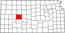 | |
| Unincorporated communities | ||