List of railway stations in Eritrea
This article is a list of the railway stations in Eritrea.
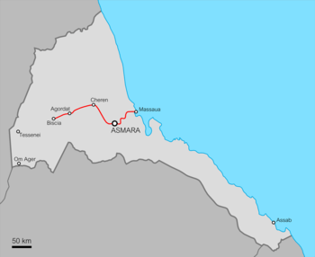
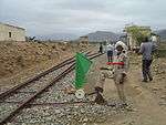
The Eritrean Railway originally ran from Massawa, a port on the Red Sea, via the capital Asmara to Agordat. The line can be divided into three sections (Massawa-Asmara; Asmara-Keren; Keren-Agordat). Additionally there was until WW2 a potash line, that was used also for civilian service.
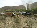
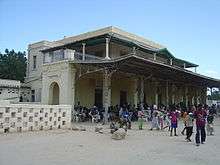
Massawa to Asmara
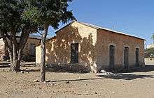
The route was built between 1887 and 1910 by the Italians, who made the two main stations (Asmara and Massawa) with typical structures of railway stations in small Italian cities.
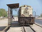
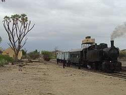
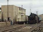
As of 2008, this is the only section open.


.jpg)
Asmara to Keren
This section (with the stations) was built between 1911 and 1923.
| Name | Distance[1] | Altitude[1] |
|---|---|---|
| Tzada Cristian | 127.2 km (79.0 mi) | 2,292 m (7,520 ft) |
| Zazzega | 136.8 km (85.0 mi) | 2,217 m (7,274 ft) |
| Dem Sabai | 148.5 km (92.3 mi) | 1,988 m (6,522 ft) |
| Andenna | 156.6 km (97.3 mi) | 1,907 m (6,257 ft) |
| Abrascico | 164.9 km (102.5 mi) | 1,783 m (5,850 ft) |
| Amba Derho | 176.3 km (109.5 mi) | 1,688 m (5,538 ft) |
| Furkuto | 185.7 km (115.4 mi) | 1,635 m (5,364 ft) |
| Elabered | 195.3 km (121.4 mi) | 1,468 m (4,816 ft) |
| Halib Mentel | 209.9 km (130.4 mi) | 1,423 m (4,669 ft) |
| Keren | 221.7 km (137.8 mi) | 1,390 m (4,560 ft) |
Keren to Agordat

This section was built between 1924 and 1929.
| Name | Distance[1] | Altitude[1] |
|---|---|---|
| Asciadira | 232.7 km (144.6 mi) | 1,204 m (3,950 ft) |
| Hummed | 245.7 km (152.7 mi) | 935 m (3,068 ft) |
| Agat | 253.3 km (157.4 mi) | 864 m (2,835 ft) |
| Darotai | 262.5 km (163.1 mi) | 795 m (2,608 ft) |
| Mai Adarte | 271.4 km (168.6 mi) | 750 m (2,461 ft) |
| Umfutat | 284.6 km (176.8 mi) | 669 m (2,195 ft) |
| Carobel | 296.4 km (184.2 mi) | 677 m (2,221 ft) |
| Agordat | 306.4 km (190.4 mi) | 606 m (1,988 ft) |
Beyond Agordat
Beyond Agordat, the rails were laid as far as Bishia, another 31 kilometres (19 mi), with plans to extend to Ellit and Teseney,[3] linking with the railway network in Sudan. However this section was never completed.[4]
There would have been a break-of-gauge at the connection between Sudan and Eritrea.
| Name | Distance | Altitude | Comments |
|---|---|---|---|
| Agordat | 232.7 km (144.6 mi) | 606 m (1,988 ft) | |
| Bishia | 263.7 km (163.9 mi) | 715 m (2,346 ft) | |
| Ellit | 290.7 km (180.6 mi) | 735 m (2,411 ft) | km uncertain |
| Teseney | 301.0 km (187.0 mi) | 600 m (1,969 ft) | km uncertain |
| 351.0 km (218.1 mi) | 531 m (1,742 ft) | km uncertain; Near Eritrea-Sudan border |
Potash railway
A 42 kilometres (26 mi) line carrying potash was built to serve the following locations:[5]
- Badda
- Adaito
The 600 mm (1 ft 11 5⁄8 in) gauge line was active from 1905: a 600-mm track gauge line was built by the Italians inside the port of Mersa Fatuma[6] and from it into the hinterland until Kululi near the Ethiopian border. This was the main source of potash in Eritrea and had to cease operations because of the Great Depression of 1929.[7]
References
- 1 2 3 4 5 6 Railways Administration in Eritrea. Imperial Ethiopian Government. 16 November 1965.
- ↑ Photo of Otumlo station
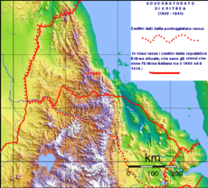
- ↑ Map of 1938 Italian Eritrea showing the expansion planned toward Ethiopia and Sudan border (the red line continuous is the Massaua-Asmara-Keren-Agordat railway)
- ↑ "The Eritrean Railway". Retrieved 24 March 2009.
- ↑ "Building the line". Retrieved 24 March 2009.
- ↑ Meleca: Map of the potash railway from Mersa Fatuma in page 3
- ↑ Neil Robinson. World Rail Atlas and Historical Summary.North, East and Central Africa. London, 2009 (p.35-39). ISBN 978-954-92184
See also
External links
![]()