Rafalivka
| Rafalivka Рафалівка Rafałówka | |||
|---|---|---|---|
| Urban-type settlement | |||
| |||
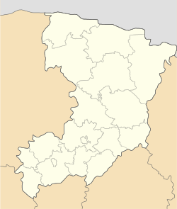 Rafalivka Location of Rafalivka in Ukraine  Rafalivka Rafalivka (Ukraine) | |||
| Coordinates: 51°18′33″N 25°59′46″E / 51.30917°N 25.99611°ECoordinates: 51°18′33″N 25°59′46″E / 51.30917°N 25.99611°E | |||
| Country |
| ||
| Oblast |
| ||
| Raion |
| ||
| Founded | 1902 | ||
| Town status | 1957 | ||
| Government | |||
| • Town Head | Yuriy Bobrovnik | ||
| Area | |||
| • Total | 12.26 km2 (4.73 sq mi) | ||
| Elevation[1] | 195 m (640 ft) | ||
| Population (2001) | |||
| • Total | 3,278 | ||
| • Density | 270/km2 (690/sq mi) | ||
| Time zone | UTC+2 (EET) | ||
| • Summer (DST) | UTC+3 (EEST) | ||
| Postal code | 34371 | ||
| Area code | +380 3634 | ||
| Website | http://rada.gov.ua/ | ||


Rafalivka (Ukrainian: Рафалівка; Polish: Rafałówka) is an urban-type settlement in Volodymyrets Raion (district) of Rivne Oblast (province) in western Ukraine. Its population is 3,278 as of the 2001 Ukrainian Census.[2] Current population: 3,495 (2017 est.)[3]
The settlement was founded in 1902 as poz'izd Polytsi (Ukrainian: роз'їзд Полиці). Its name was changed to Nova Rafalivka (Ukrainian: Нова Рафалівка) in 1927. The settlement's name was again changed to its current "Rafalivka" when it acquired the status of an urban-type settlement in 1957.[2]
See also
- Volodymyrets, the other urban-type settlement in Volodymyrets Raion of Rivne Oblast
References
- ↑ "Rafalivka (Rivne Oblast, Volodymyrets Raion)". weather.in.ua. Retrieved 9 February 2012.
- 1 2 "Rafalivka, Rivne Oblast, Volodymyrets Raion". Regions of Ukraine and their Structure (in Ukrainian). Verkhovna Rada of Ukraine. Retrieved 9 February 2012.
- ↑ "Чисельність наявного населення України (Actual population of Ukraine)" (in Ukrainian). State Statistics Service of Ukraine. Retrieved 26 August 2017.
| Raions | |||||
|---|---|---|---|---|---|
| Cities |
| ||||
| |||||
This article is issued from
Wikipedia.
The text is licensed under Creative Commons - Attribution - Sharealike.
Additional terms may apply for the media files.