RAF Down Ampney
| RAF Down Ampney | |||||||||||||||||||
|---|---|---|---|---|---|---|---|---|---|---|---|---|---|---|---|---|---|---|---|
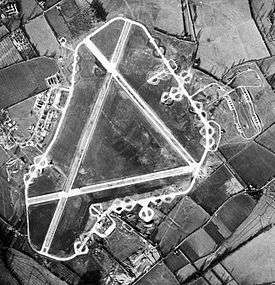 Aerial photograph of Down Ampney airfield, 4 December 1943. The bomb dump is to the right (east) of the airfield, the technical site and barrack sites are to the left. | |||||||||||||||||||
| Summary | |||||||||||||||||||
| Owner | Air Ministry | ||||||||||||||||||
| Operator | Royal Air Force | ||||||||||||||||||
| Location | Down Ampney, Gloucestershire | ||||||||||||||||||
| Built | 1943 | ||||||||||||||||||
| In use | 1944-1947 | ||||||||||||||||||
| Elevation AMSL | 270 ft / 82 m | ||||||||||||||||||
| Coordinates | 51°40′01″N 01°50′22″W / 51.66694°N 1.83944°WCoordinates: 51°40′01″N 01°50′22″W / 51.66694°N 1.83944°W | ||||||||||||||||||
| Map | |||||||||||||||||||
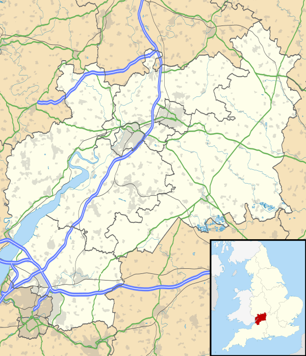 RAF Down Ampney Location in Gloucestershire | |||||||||||||||||||
| Runways | |||||||||||||||||||
| |||||||||||||||||||
RAF Down Ampney was a Royal Air Force station located 1.8 miles (2.9 km) north east of Cricklade, Wiltshire and 3 miles (4.8 km) south west of RAF Fairford, Gloucestershire. The airfield operated during World War II from February 1944 until February 1947.
Down Ampney was part of a group of airfields dedicated to air transportation, alongside RAF Broadwell and RAF Blakehill Farm.
Based units
No. 48 Squadron RAF and No. 271 Squadron RAF flew Douglas Dakotas on major missions. On D-Day they dropped the main elements of the 3rd Parachute Brigade in Normandy as well as towing Airspeed Horsa gliders across the English Channel. They were also active in Operation Market Garden (Arnhem) and the Rhine crossing.
Memorial
A memorial has been erected at the southern end of what was the main runway.[1] which reads:
FROM THIS AIRFIELD IN 1944-5
DOUGLAS DAKOTAS FROM 48 AND
271 SQUADRONS RAF TRANSPORT
COMMAND CARRIED THE 1ST AND 6TH
AIRBORNE DIVISIONS UNITS OF
THE AIR DESPATCH REGIMENT
AND HORSA GLIDERS FLOWN BY
THE GLIDER PILOTS REGIMENT TO
NORMANDY – ARNHEM AND ON THE
CROSSING THE RHINE OPERATIONS
WE WILL REMEMBER THEM
References
External links
![]()