RAF Atherstone
| RAF Atherstone | |||||||||||||||||||
|---|---|---|---|---|---|---|---|---|---|---|---|---|---|---|---|---|---|---|---|
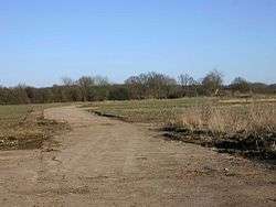 A section of perimeter track at the airfield | |||||||||||||||||||
| Summary | |||||||||||||||||||
| Airport type | Military | ||||||||||||||||||
| Operator | Royal Air Force | ||||||||||||||||||
| Location | Atherstone on Stour | ||||||||||||||||||
| Built | 1940 | ||||||||||||||||||
| In use | 1941-1945 | ||||||||||||||||||
| Elevation AMSL | 193 ft / 116 m | ||||||||||||||||||
| Coordinates | 52°9′40″N 001°41′12″W / 52.16111°N 1.68667°WCoordinates: 52°9′40″N 001°41′12″W / 52.16111°N 1.68667°W | ||||||||||||||||||
| Map | |||||||||||||||||||
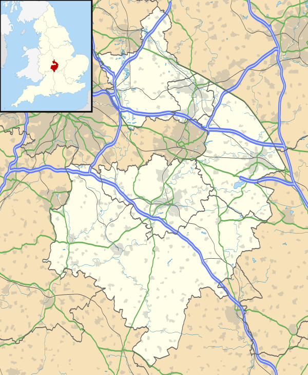 RAF Atherstone Location in Warwickshire | |||||||||||||||||||
| Runways | |||||||||||||||||||
| |||||||||||||||||||
|
Operational dates.[1] | |||||||||||||||||||
RAF Atherstone was a former Royal Air Force station located 2.25 miles (3.62 km) south of Stratford-upon-Avon, Warwickshire, England, 7.5 miles (12.1 km) north-west of Shipston on Stour.
The airfield opened in 1941 when it was used by No. 22 Operational Training Unit RAF as a satellite from RAF Wellesbourne Mountford.[1] Through its life the airfield was home to a number of units before closing in 1945. However local sources state that the airfield was wrongly cited because it was directly on the flightpath from Wellesbourne and also the whole airfield was on hill, the main runway having quite a steep slope.
Atherstone had its name changed during operations when, in May 1942, it became RAF Stratford.[2]
Posted units
The authorisation for a satellite for No. 22 Operational Training Unit RAF (OTU) was given on 18 June 1940 yet it took over a year until 5 July 1941 that the station was finally opened by an advance party from RAF Wellesbourne Mountford with their Vickers Wellingtons.[1] During 1942 the station's name was changed from RAF Atherstone to RAF Stratford. This is nothing to do with airfields with the same name. The airfield is at Atherstone-on-Stour, a sparsely populated rural parish, too small to appear on many maps and which never had a railway station. The nearest station is Stratford-on-Avon on the GWR Birmingham to Bristol line. The RAF dropped the "on-Stour" from the name and don't seem to have realised there is a large town, 40 miles away in North Warwickshire (near to Tamworth in Staffordshire) called Atherstone. It is on the maps and does have a station and not surprisingly many servicemen posted to Atherstone, Warwickshire ended up at the wrong place. This Atherstone is on the LMSR west coast main line, and to get to Stratford involves a circuitous journey of three separate trains and a walk across Birmingham between the LMS & GWR stations, probably a half days travel. When it is borne in mind that nearly 90% of routine service personnel movements were by rail and OTUs had substantial intakes of trainees once a fortnight this presented a problem. The RAF eventually realised their mistake and the airfield was renamed after the local railway station.
no 312 Ferry Training Unit (FTU) flying the Wellington used the airfield for just under eight months between 24 April 1943 and 17 December 1943 with the unit located at Wellesbourne Mountford with RAF Gaydon and Stratford used as a satellites.[3]
However, on 7 March 1944 the airfield was transferred back to No. 22 OTU [1] because the unit now had 81 Wellington III/X's with 33 of these coming from No. 23 OTU which had disbanded on 7 March 1944.[4] Although before long No. 22 OTU had left and the station came under control from the Signals Flying Unit from RAF Honiley but not long after flying ceased at Stratford and the station was placed on a care and maintenance basis.[5]
Accidents and incidents
During life as a RAF training airfield accidents were not far away, with a number of airmen killed during training.
| Date | Incident | Reference |
|---|---|---|
| 23 April 1944 | Vickers Wellington BK541 of No. 22 Operational Training Unit RAF (OTU) crashed on overshoot following engine failure. | [6] |
| 11 June 1944 | Wellington BK186 of 22 OTU had to crash land after an engine failure. | [6] |
| 8 December 1944 | Wellington LN845 –C of No. 11 Operational Training Unit RAF overshot a forced landing and ran onto the railway at the end of the runway. The aircraft was only lightly damaged until it was hit by a train. | [6] |
| 19 October 1945 | Wellington PF882 of the Signals Flying Unit overshot landing and ran into the railway embankment. | [7] |
Current use
Today the airfield is home to a small number of warehouses however the original basic layout can still be made out, including the runways and a large amount of the perimeter track which used to connect the runways with the dispersal hardstandings and the technical site.[1]
The airfield has a claim to fame, in that the TV Teletubbies programmes were made here.
Unfortunately there was also the major warehouse fire here in which several volunteer firemen from nearby Alcester died.
At its peak there were over 1650 service men and women stationed here as well as civilian workers. At one time this OTU operated 81 Vickers Wellingtons, probably some Avro Ansons and a target towing flight with 6 Miles Martinets. Passing through the area now the history seems unbelievable.
References
Citations
- 1 2 3 4 5 "RAF Stratford". Control Towers. Retrieved 16 April 2012.
- ↑ "RAF Stratford". Atlantik Wall. Retrieved 16 April 2012.
- ↑ "Military flying units in the south west Midlands". Aviation Archaeology. Retrieved 16 April 2012.
- ↑ Lake 1999, p. 147.
- ↑ Bowyer 1983, p. 242.
- 1 2 3 "Military aircraft crashes in the south west Midlands - 1944". Aviation Archaeology. Retrieved 16 April 2012.
- ↑ "Military aircraft crashes in the south west Midlands - 1945". Aviation Archaeology. Retrieved 16 April 2012.
Bibliography
- Bowyer, M.J.F. Action Stations 6: Military airfield of the Cotswolds and the Central Midlands. Cambridge, Cambridgeshire, Patrick Stephens Ltd., 1983. ISBN 0-85059-529-0.
- Lake, A Flying Units of the RAF. Shrewsbury, Airlife Publishing Ltd., 1999. ISBN 1-84037-086-6.
- Smith, Graham, Warwickshire Airfields in the Second World War, countryside books, airfield series, ISBN 1-85306-867-5.
External links
Royal Air Force portal | ||
| Formations and units |  | |
| Branches and components | ||
| Reserve forces | ||
| Associated civil organisations | ||
| Equipment | ||
| Personnel | ||
| Appointments | ||
| Symbols and uniform | ||