Qahar Right Front Banner
| Chahar Right Front Banner 察哈尔右翼前旗 • ᠴᠠᠬᠠᠷᠪᠠᠷᠠᠭᠤᠨᠭᠠᠷᠤᠨᠡᠮᠦᠨᠡᠳᠦᠬᠣᠰᠢᠭᠤ | |
|---|---|
| Banner | |
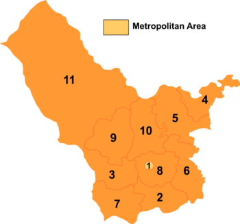 Map of Ulanqab's divisions: Chahar Right Front Banner is 8 on this map | |
 Chahar YYQY Location in Inner Mongolia | |
| Coordinates: 40°47′N 113°13′E / 40.783°N 113.217°ECoordinates: 40°47′N 113°13′E / 40.783°N 113.217°E | |
| Country | People's Republic of China |
| Region | Inner Mongolia |
| Prefecture-level city | Ulaan Chab |
| Administrative Centre | Tuguiwula Town |
| Area | |
| • Total | 2,734 km2 (1,056 sq mi) |
| Elevation | 1,335 m (4,380 ft) |
| Population | |
| • Total | 280,000 |
| Time zone | UTC+8 (China Standard) |
Chahar or Qahar Right Front Banner (Mongolian: ᠴᠠᠬᠠᠷ ᠪᠠᠷᠠᠭᠤᠨ ᠭᠠᠷᠤᠨ ᠡᠮᠦᠨᠡᠳᠦ ᠬᠣᠰᠢᠭᠤ; Цахар баруун гарын өмнөд хошуу; Čaqar Baraɣun Ɣarun Emünedü qosiɣu; simplified Chinese: 察哈尔右翼前旗; traditional Chinese: 察哈爾右翼前旗; pinyin: Cháhā'ěr Yòuyì Qiánqí) is a Banner of Inner Mongolia, People's Republic of China, surrounding Jining District and bordering Xinghe County to the east, Fengzhen City to the south, Zhuozi County to the west, and Chahar Right Back Banner to the north. Its territory includes Lake Huangqi. It is under the administration of Ulaan Chab City. Its most important settlement is Tuguiwula, where Tuguiwula Railway Station is located.
References
- www.xzqh.org (in Chinese)
This article is issued from
Wikipedia.
The text is licensed under Creative Commons - Attribution - Sharealike.
Additional terms may apply for the media files.