Putnam Township, Anderson County, Kansas
| Putnam Township | |
|---|---|
| Township | |
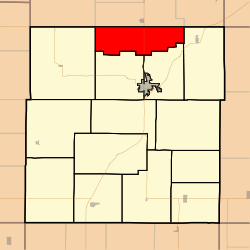 Location in Anderson County | |
| Coordinates: 38°22′10″N 095°16′01″W / 38.36944°N 95.26694°WCoordinates: 38°22′10″N 095°16′01″W / 38.36944°N 95.26694°W | |
| Country | United States |
| State | Kansas |
| County | Anderson |
| Area | |
| • Total | 33.6 sq mi (86.9 km2) |
| • Land | 33.4 sq mi (86.6 km2) |
| • Water | 0.2 sq mi (0.4 km2) 0.41% |
| Elevation | 1,014 ft (309 m) |
| Population (2010) | |
| • Total | 305 |
| • Density | 9/sq mi (3.5/km2) |
| GNIS feature ID | 0477589 |
Putnam Township is a township in Anderson County, Kansas, United States. As of the 2010 census, its population was 305.[1]
History
Putnam Township was established in 1870. It was named for Leander Putnam.[2]
Geography
Putnam Township covers an area of 33.6 square miles (86.9 km2) and contains no incorporated settlements. According to the USGS, it contains one cemetery, West Scipio.
The stream of Dry Branch runs through this township.
References
- ↑ "Geographic Identifiers: 2010 Demographic Profile Data (G001): Putnam township, Anderson County, Kansas". U.S. Census Bureau, American Factfinder. Retrieved May 13, 2013.
- ↑ Johnson, William A. (1877). The History of Anderson County, Kansas, from Its First Settlement to the Fourth of July, 1876. Kauffman & Iler. p. 279.
External links
Municipalities and communities of Anderson County, Kansas, United States | ||
|---|---|---|
| Cities | 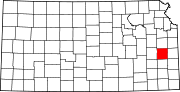 | |
| CDPs | ||
| Unincorporated communities | ||
| Ghost town | ||
| Townships | ||
This article is issued from
Wikipedia.
The text is licensed under Creative Commons - Attribution - Sharealike.
Additional terms may apply for the media files.