Puka Saya (Moquegua)
| Puka Saya | |
|---|---|
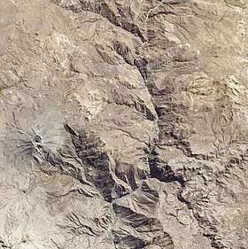 Satellite image of the volcano Ubinas (on the left) and Puka Saya (lower left) | |
| Highest point | |
| Elevation | 5,320 m (17,450 ft) [1] |
| Coordinates | 16°27′33″S 70°56′10″W / 16.45917°S 70.93611°WCoordinates: 16°27′33″S 70°56′10″W / 16.45917°S 70.93611°W |
| Geography | |
 Puka Saya Peru | |
| Location | Peru, Moquegua Region, General Sanchez Cerro Province |
| Parent range | Andes |
Puka Saya (Quechua puka red, saya slope,[2] "red slope", Hispanicized Pucasaya) is a 5,320-metre-high (17,454 ft) mountain in the Andes of Peru. It is situated southeast of the salt lake named Salinas. The mountain is located in the Moquegua Region, General Sánchez Cerro Province, Matalaque District, southwest of the active Ubinas volcano.[3] Puka Saya lies on the southern border of the buffer zone of the Salinas and Aguada Blanca National Reservation.[1]
See also
References
- 1 2 Valoración del Servicio Ambiental de Provisión de Agua con Base en la Reserva Nacional Salinas y Aguada Blanca - Cuenca del Río Chili, PROFONANPE, Lima, 2007
- ↑ Teofilo Laime Ajacopa, Diccionario Bilingüe Iskay simipi yuyayk'ancha, La Paz, 2007 (Quechua-Spanish dictionary)
- ↑ escale.minedu.gob.pe - UGEL map of the General Sánchez Cerro (Moquegua Region)
This article is issued from
Wikipedia.
The text is licensed under Creative Commons - Attribution - Sharealike.
Additional terms may apply for the media files.