Prilep Municipality
| Municipality of Prilep Општина Прилеп | |||
|---|---|---|---|
| Urban municipality | |||
| |||
 | |||
| Country |
| ||
| Region | Pelagonia Statistical Region | ||
| Municipal seat | Prilep | ||
| Government | |||
| • Mayor | Ilija Jovanoski (SDSM) | ||
| Area | |||
| • Total | 1,194.44 km2 (461.18 sq mi) | ||
| Population | |||
| • Total | 76,768 | ||
| • Density | 64.27/km2 (166.5/sq mi) | ||
| Time zone | UTC+1 (CET) | ||
| Area code(s) | 048 | ||
| car plates | PP | ||
| Website | http://www.Prilep.gov.mk | ||


Prilep (Macedonian: Прилеп [ˈpriːlɛp] (![]()
Geography
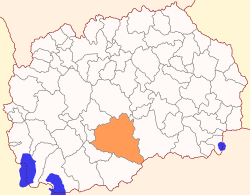
The municipality borders Čaška and Dolneni municipalities to the north, Kavadarci Municipality to the east, Krivogaštani, Mogila and Novaci municipalities to the west, and Greece to the south.
The municipality spreads over the northeastern part of the Pelagonia valley, it takes contains much of the Mariovo region.
Demographics
The population of the municipality is 76,768 of whom approximately 70,000 live in the municipality center Prilep, the rest live in the villages of the municipality.[1]
According to the last national Macedonian census from 2002 the majority in the municipality is represented by the ethnic Macedonians, 70,878 (92.3%). Other ethnic groups include: Romani (4,433), Turks (917), Serbs (172), Bosniaks (86), Albanians (22), Vlachs (17), and others (243).
Inhabited places
The number of the inhabited places in the municipality is 59. There is one city and 58 villages. Lots of villages have small populations and some are even abandoned.
References
- ↑ 2002 census results in English and Macedonian (PDF)