Prescott Valley, Arizona
| Prescott Valley, Arizona | ||
|---|---|---|
| Town | ||
| ||
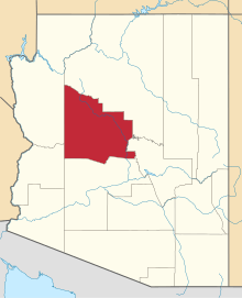
 Location of Prescott Valley in Yavapai County, Arizona | ||
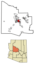
 Prescott Valley, Arizona Location in Arizona  Prescott Valley, Arizona Prescott Valley, Arizona (the US) | ||
| Coordinates: 34°36′8″N 112°19′19″W / 34.60222°N 112.32194°WCoordinates: 34°36′8″N 112°19′19″W / 34.60222°N 112.32194°W | ||
| Country | United States | |
| State | Arizona | |
| County | Yavapai | |
| Incorporated (town) | 1978 | |
| Government | ||
| • Town Council | Mayor Harvey C. Skoog, Vice Mayor Lora Lee Nye; Council Members: Richard Anderson, Martin Grossman, Mary Mallory, Jodi Rooney, Michael Whiting. | |
| Area[1] | ||
| • Town | 40.80 sq mi (105.67 km2) | |
| • Land | 40.80 sq mi (105.67 km2) | |
| • Water | 0.00 sq mi (0.00 km2) | |
| Elevation | 5,026 ft (1,532 m) | |
| Population (2010)[2] | ||
| • Town | 45,500 | |
| • Estimate (2016)[3] | 45,500 | |
| • Density | 1,057.13/sq mi (408.16/km2) | |
| • Metro | 218,844 (US: 199th) | |
| Time zone | UTC-7 (MST) | |
| ZIP codes | 86312, 86314, 86315 | |
| Area code(s) | 928 | |
| FIPS code | 04-57450 | |
| GNIS feature ID | 33193 | |
| Website | http://www.pvaz.net/ | |

Prescott Valley is a town located in Yavapai County, Arizona, United States, about 8 miles east of Prescott, which it has surpassed in growth. Prescott Valley was the seventh fastest-growing place among all cities and towns in Arizona between 1990 and 2000, with a current population (October 2016) of about 45,500 residents.
History
Prescott Valley’s Fitzmaurice Ruins contain artifacts from the early Mountain Patayan people who inhabited the area some 1,400 years ago.
The Walker party discovered gold along Lynx Creek[4] in 1863. The Lynx Creek placers went on to produce a recorded 29,000 troy ounces (900 kg) of gold. Estimates of actual production range up to 80,000 troy ounces (2,500 kg), which would be worth about $108 million at 2017 prices.[5]
Prescott Valley, formerly known as Lonesome Valley, was settled by ranchers in the 1880s, raising beef to supply the miners and new settlers. The Fain family, pioneer ranchers, still ranch in the valley.[6]
Thomas Gibson Barlow-Massicks arrived in the area in the early 1890s and built the historic "castle" that still stands in Fain Park. Massicks had a hydraulic gold mining operation in Lynx Creek Canyon and built the company mining camp of Massicks, Arizona just east of his Victorian home, the castle. The fireplace with chimney just inside the castle's fence is all that remains of the Massicks store. Massicks accidentally shot himself and died in April 1899 at the age of 37. In the 1930s, there was a gold dredging operation, the Doodle Bug Diggings, farther east in Lynx Creek Canyon.[7]
In the mid-1960s, Prescott Valley Incorporated, a real-estate company from Phoenix, purchased land in an area 10 miles east of Prescott known as Lonesome Valley. In 1966, representatives from Prescott Valley Inc. began traveling to the Midwest to sell home lots. By 1978, more than 1,500 residents were living in the unincorporated area now known as Prescott Valley. In 1978, 80 percent of the voters of Prescott Valley voted for incorporation as a town.[6] The Town will celebrate its 40th anniversary during 2018.
In 1985, Prescott Valley got its first licensed radio station. The station was the first solar powered FM station in the United States. Today, Arizona's Hometown Radio Group has grown to seven stations throughout Arizona.[8]
Geography
Prescott Valley (locally, PV) is located in central Arizona approximately 85 miles (137 km) north of Phoenix at 5,100 feet (1,600 m). elevation. PV has good access to Arizona State Route 89, SR-89A and SR-69, connecting to Interstates 17 and 40. Air service is available at Ernest A. Love Field, about 8 miles (13 km) northwest.
One of PV’s landmarks, Glassford Hill (elevation 6,177 feet (1,883 m)) was an active volcano between 10 and 14 million years ago.[9] Colonel William A. Glassford traveled the area in the 1880s and helped build a system of 27 heliograph stations to monitor the movements of Apache Indians, U.S. military troops and civilians. Glassford Hill was a part of that early communications system.[10]
Demographics
| Historical population | |||
|---|---|---|---|
| Census | Pop. | %± | |
| 1970 | 244 | — | |
| 1980 | 2,284 | 836.1% | |
| 1990 | 8,904 | 289.8% | |
| 2000 | 23,535 | 164.3% | |
| 2010 | 38,822 | 65.0% | |
| Est. 2016 | 43,132 | [3] | 11.1% |
| U.S. Decennial Census[11] | |||
Prescott Valley is part of the West region of Arizona, including the Mohave, LaPaz, and Yuma counties, which collectively increased their population by 25 percent between 2000 and 2010.[12]
Prescott Valley is composed of 94 percent white/Caucasian, 7 percent of which are Spanish/Hispanic/Latino. [13]
Economy
Prescott Valley's economy consists of industrial, manufacturing, retail and service businesses. Many retirees live there due to relatively inexpensive housing and the mild climate.
Top employers
According to the Town of Prescott Valley,[14] the top employers in the town as of July 2017 are:
| # | Employer | # of Employees |
|---|---|---|
| 1 | Humboldt Unified School District | 776 |
| 2 | Yavapai Regional Medical Center East | 662 |
| 3 | MI Windows and Doors | 339 |
| 4 | Walmart | 297 |
| 5 | Town of Prescott Valley | 295 |
| 6 | Mountain Valley Regional Rehabilitation Hospital | 235 |
| 7 | Ace Hardware Retail Support Center | 220 |
| 8 | Fry's Food and Drug | 212 |
| 9 | Yavapai College - Prescott Valley Campus | 150 |
| 10 | PrintPak Inc. | 131 |
| 11 | Home Depot | 127 |
| 12 | Leidos | 127 |
| 13 | Superior Industries | 114 |
| 14 | Safeway, Inc. | 104 |
Culture
Prescott was the location of Arizona's first Elks Lodge (BPOE). In December 1895 a group of enterprising businessmen in Prescott, sturdy products of the early west, chartered the original petition for a dispensation and later established the Prescott Elks Lodge #330. "Mother Lodge of Arizona" The Prescott Elks Opera House was built by the lodge in 1905. The Prescott Elks Lodge is now located in Prescott Valley and has served the community for more than 116 years.
Attractions
Prescott Valley is located within 10 minutes of the Prescott National Forest, with lakes, fishing, hiking and camping. The Entertainment District is located downtown and offers a variety of restaurants, a 6,000-seat events center,[15] a multi-screen movie theater, and retail shops. There are 27 parks. Fain Park preserves remnants of early 20th century gold mining along Lynx Creek.
The Northern Arizona Suns, a minor league basketball team in the NBA G League, plays out of the Prescott Valley Event Center. In April 2016, the National Basketball Association's Phoenix Suns purchased their affiliated NBA D-League team, the Bakersfield Jam, and relocated the team to Prescott Valley beginning with the 2016–17 season.
The Arizona Sundogs minor professional ice hockey team called Prescott Valley its home from 2006 to 2014. The team won the Central Hockey League championship in 2008.
The Arizona Adrenaline indoor football team also played two seasons in the Tim's Toyota Center, now the Prescott Valley Event Center.
Prescott Valley’s Mountain Valley Splash is an outdoor community pool that seasonally offers children’s swim lessons, water aerobics, school swim team practices, and recreational swim. The pool features a splash pad, fountains and a water slide.
Transportation
There are three main thoroughfares in and around Prescott Valley which include Arizona State Route 89A, Arizona State Route 69 and Fain Road. Arizona State Route 89A is a four lane divided highway that connects Prescott Valley to northern Prescott and Ernest A. Love Field Airport to the west and to the east Jerome, Cottonwood and Sedona. Arizona State Route 69 is a six lane roadway that connects Prescott Valley to downtown Prescott and Interstate 17. Fain Road is a four lane limited access freeway that links Arizona State Route 89A and Arizona State Route 69 in the east. In 2006 the town of Prescott Valley proposed the Great western Corridor from Arizona State Route 89A to Outer Loop road in Chino Valley, Arizona.[16]
Notable residents
- Sharlot Hall's family had a ranch between present-day Prescott Valley and Dewey. She lived there from 1890 to about 1925. The site is now the Orchard Ranch trailer park.[17]
References
- ↑ "2016 U.S. Gazetteer Files". United States Census Bureau. Retrieved Jul 18, 2017.
- ↑ "American FactFinder". United States Census Bureau. Retrieved 2014-07-06.
- 1 2 "Population and Housing Unit Estimates". Retrieved June 9, 2017.
- ↑ Lynx Creek https://highlandscenter.org/wp-content/uploads/2017/01/Highlands-Trail-Geology-Map.pdf
- ↑ https://www.apmex.com/spotprices/silver-prices
- 1 2 Jean Cross, 2009, Images of America: Prescott Valley, Arcadia Publishing. ISBN 0-7385-7070-2
- ↑ Sharlot Hall Museum
- ↑ "Arizona's Hometown Radio".
- ↑ "About Prescott Valley". Town of Prescott Valley. Archived from the original on January 4, 2018. Retrieved January 4, 2018.
- ↑ "Prescott Valley Historical Society".
- ↑ "Census of Population and Housing". Census.gov. Retrieved June 4, 2016.
- ↑ Teixeira, Ruy (2012). America's New Swing Region: Changing Politics and Demographics in the Mountain West. Brookings Institution Press. ISBN 9780815722861.
- ↑ "The Town of Prescott Valley, Arizona Report of Results". The National Citizen Survey. 2007.
- ↑ Town of Prescott Valley
- ↑ "Prescott Valley Event Center". Prescott Valley Event Center. Archived from the original on November 30, 2017. Retrieved November 30, 2017.
- ↑ http://www.pvaz.net/DocumentCenter/Home/View/656
- ↑ Orchard Ranch history
External links
- Town of Prescott Valley
- Prescott Event Center
- Prescott Daily Courier – Newspaper
- Prescott Valley Tribune – Newspaper
- Lonesome Valley Newspaper - Newspaper
- Prescott Elks Lodge # 330
- Prescott Valley's First Radio Station 106.7 FM