Port-de-Bouc
| Port-de-Bouc | ||
|---|---|---|
| Commune | ||
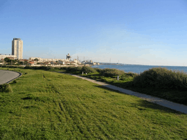 Aigues Douces area | ||
| ||
 Port-de-Bouc Location within Provence-A.-C.d'A. region  Port-de-Bouc | ||
| Coordinates: 43°24′21″N 4°59′21″E / 43.4058°N 4.9892°ECoordinates: 43°24′21″N 4°59′21″E / 43.4058°N 4.9892°E | ||
| Country | France | |
| Region | Provence-Alpes-Côte d'Azur | |
| Department | Bouches-du-Rhône | |
| Arrondissement | Istres | |
| Canton | Martigues | |
| Intercommunality | Aix-Marseille-Provence | |
| Government | ||
| • Mayor (2008–2014) | Patricia Fernandez-Pédinielli | |
| Area1 | 11.46 km2 (4.42 sq mi) | |
| Population (2008)2 | 17,207 | |
| • Density | 1,500/km2 (3,900/sq mi) | |
| Time zone | UTC+1 (CET) | |
| • Summer (DST) | UTC+2 (CEST) | |
| INSEE/Postal code | 13077 /13110 | |
| Elevation |
0–68 m (0–223 ft) (avg. 15 m or 49 ft) | |
|
1 French Land Register data, which excludes lakes, ponds, glaciers > 1 km2 (0.386 sq mi or 247 acres) and river estuaries. 2 Population without double counting: residents of multiple communes (e.g., students and military personnel) only counted once. | ||
.svg.png)
Port-de-Bouc is a commune in the Bouches-du-Rhône department in southern France.
Population
| Historical population | ||
|---|---|---|
| Year | Pop. | ±% |
| 1866 | 1,379 | — |
| 1872 | 995 | −27.8% |
| 1876 | 929 | −6.6% |
| 1881 | 1,473 | +58.6% |
| 1886 | 1,442 | −2.1% |
| 1891 | 1,479 | +2.6% |
| 1896 | 1,300 | −12.1% |
| 1901 | 2,239 | +72.2% |
| 1906 | 2,602 | +16.2% |
| 1911 | 3,437 | +32.1% |
| 1921 | 4,141 | +20.5% |
| 1926 | 4,385 | +5.9% |
| 1931 | 5,695 | +29.9% |
| 1936 | 6,163 | +8.2% |
| 1946 | 6,625 | +7.5% |
| 1954 | 8,551 | +29.1% |
| 1962 | 12,510 | +46.3% |
| 1968 | 14,080 | +12.5% |
| 1975 | 21,424 | +52.2% |
| 1982 | 20,106 | −6.2% |
| 1990 | 18,786 | −6.6% |
| 1999 | 16,686 | −11.2% |
| 2008 | 17,207 | +3.1% |
See also
References
| Wikimedia Commons has media related to Port-de-Bouc. |
| Authority control |
|---|
This article is issued from
Wikipedia.
The text is licensed under Creative Commons - Attribution - Sharealike.
Additional terms may apply for the media files.