Meyrargues
| Meyrargues | ||
|---|---|---|
| Commune | ||
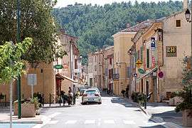 The main street of Meyrargues | ||
| ||
 Meyrargues Location within Provence-A.-C.d'A. region  Meyrargues | ||
| Coordinates: 43°38′11″N 5°31′45″E / 43.6364°N 5.5292°ECoordinates: 43°38′11″N 5°31′45″E / 43.6364°N 5.5292°E | ||
| Country | France | |
| Region | Provence-Alpes-Côte d'Azur | |
| Department | Bouches-du-Rhône | |
| Arrondissement | Aix-en-Provence | |
| Canton | Trets | |
| Intercommunality | Aix-Marseille-Provence | |
| Government | ||
| • Mayor (2008–2014) | Mireille Jouve | |
| Area1 | 41.67 km2 (16.09 sq mi) | |
| Population (2008)2 | 3,473 | |
| • Density | 83/km2 (220/sq mi) | |
| Time zone | UTC+1 (CET) | |
| • Summer (DST) | UTC+2 (CEST) | |
| INSEE/Postal code | 13059 /13650 | |
| Elevation |
186–554 m (610–1,818 ft) (avg. 206 m or 676 ft) | |
|
1 French Land Register data, which excludes lakes, ponds, glaciers > 1 km2 (0.386 sq mi or 247 acres) and river estuaries. 2 Population without double counting: residents of multiple communes (e.g., students and military personnel) only counted once. | ||
.svg.png)
Meyrargues is a commune in the Bouches-du-Rhône department in southern France.
Population
| Historical population | ||
|---|---|---|
| Year | Pop. | ±% |
| 1793 | 892 | — |
| 1800 | 829 | −7.1% |
| 1806 | 929 | +12.1% |
| 1821 | 962 | +3.6% |
| 1831 | 1,009 | +4.9% |
| 1836 | 1,030 | +2.1% |
| 1841 | 1,035 | +0.5% |
| 1846 | 1,125 | +8.7% |
| 1851 | 1,098 | −2.4% |
| 1856 | 1,020 | −7.1% |
| 1861 | 1,143 | +12.1% |
| 1866 | 1,354 | +18.5% |
| 1872 | 1,296 | −4.3% |
| 1876 | 1,117 | −13.8% |
| 1881 | 967 | −13.4% |
| 1886 | 880 | −9.0% |
| 1891 | 939 | +6.7% |
| 1896 | 1,005 | +7.0% |
| 1901 | 1,021 | +1.6% |
| 1906 | 953 | −6.7% |
| 1911 | 853 | −10.5% |
| 1921 | 772 | −9.5% |
| 1926 | 826 | +7.0% |
| 1931 | 879 | +6.4% |
| 1936 | 810 | −7.8% |
| 1946 | 935 | +15.4% |
| 1954 | 1,020 | +9.1% |
| 1962 | 1,535 | +50.5% |
| 1968 | 2,196 | +43.1% |
| 1975 | 2,222 | +1.2% |
| 1982 | 2,406 | +8.3% |
| 1990 | 2,814 | +17.0% |
| 1999 | 3,284 | +16.7% |
| 2008 | 3,473 | +5.8% |
Personalities
- Writer Joseph d'Arbaud was born in Meyrargues.
- Raouia Rouabhia - Algerian international volleyball player
See also
References
| Wikimedia Commons has media related to Meyrargues. |
This article is issued from
Wikipedia.
The text is licensed under Creative Commons - Attribution - Sharealike.
Additional terms may apply for the media files.