Ponta do Lobo
| Ponta do Lobo | |
|---|---|
 Cape Verde | |
| Location | Eastern Santiago, Cape Verde |
| Coordinates | 14°59′14″N 23°25′48″W / 14.9871°N 23.4301°WCoordinates: 14°59′14″N 23°25′48″W / 14.9871°N 23.4301°W |
| Offshore water bodies | Atlantic Ocean |
Ponta do Lobo is a headland in the southeastern part of the island of Santiago, Cape Verde. It is in the municipality of São Domingos, 4 km east of Vale da Custa, 4 km southeast of Moia Moia and 11 km northeast of Praia. The nearby bay Porto Lobo was mentioned as P. Lobo on the 1747 map by Jacques-Nicolas Bellin.[1] The Ponta do Lobo Lighthouse stands on the headland.[2]
References
- ↑ Jacques-Nicolas Bellin (1747). "Carte des Isles du Cap Verd = Kaart van de Eilanden van Kabo Verde" (in French).
- ↑ Rowlett, Russ. "Lighthouses of Cape Verde". The Lighthouse Directory. University of North Carolina at Chapel Hill.
The island of Santiago | ||
|---|---|---|
| Mountains | 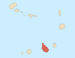 | |
| Streams | ||
| Points and promontories | ||
| Other geographic features | ||
| Transportation | ||
| Other topics | ||
| ||
This article is issued from
Wikipedia.
The text is licensed under Creative Commons - Attribution - Sharealike.
Additional terms may apply for the media files.